Last Updated on 11/09/2023
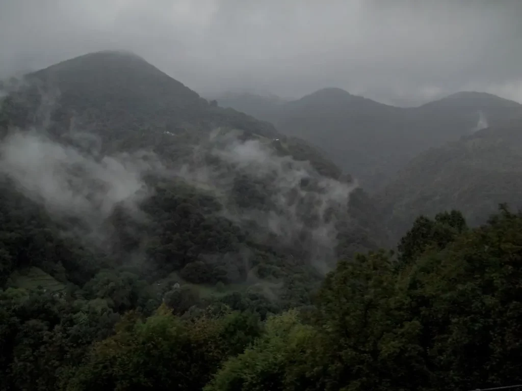
Honestly, initially Centovalli railway was listed somewhere in the last places in the programm, since the photos did not make much of an impression. And we took the train only because after a short pause in the Verzasca Valley it started raining and was not going to stop. However, the views turned out to be amazing (at least in the rain) and the trip is highly recommended.
About Verzasca Valley
Valle Maggia
Lake Lugano attractions map
Ticino attractions map. Locarno, Bellinzona and valleys
Lake Maggiore Attractions of Italian part
Ticino guest cards and public transport Ticino
Lake Maggiore. Locarno and Ascona
Lake Lugano. 3. Morcote, Caslano
5 best viewpoints of Lake Lugano
I really liked the way we discussed this valley with the woman from the tourist info in Locarno. I ask: “In which village can we go out for an hour and go back?” She: “With a stroller in any, only carry the child in your arms.” Me: “We can carry. But which village is the most recommended?” She: “They are all good, but you won’t work with a stroller.” Me: “And which one is considered the most beautiful?” She: “All. But it won’t work with a stroller.” At this point, I decided that further inquiries were pointless. So we still do not know for certain where it is best to walk there.
We decided to go to Camedo. This is the last station in Swiss territory. Most of the trains from here go back and only express trains go to the Italian Domodosolla without a change (and not all of them stop in Camedo).
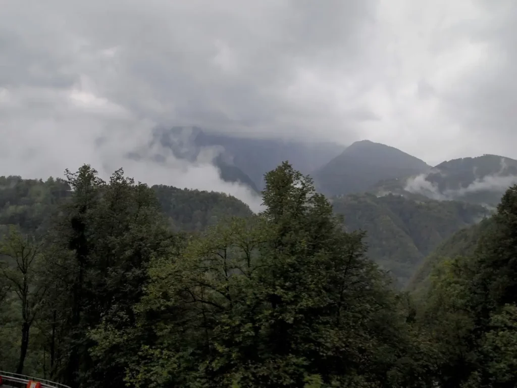
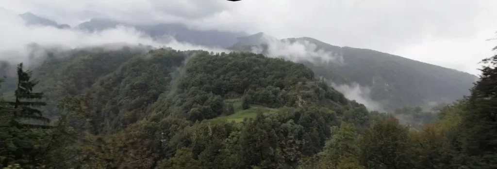
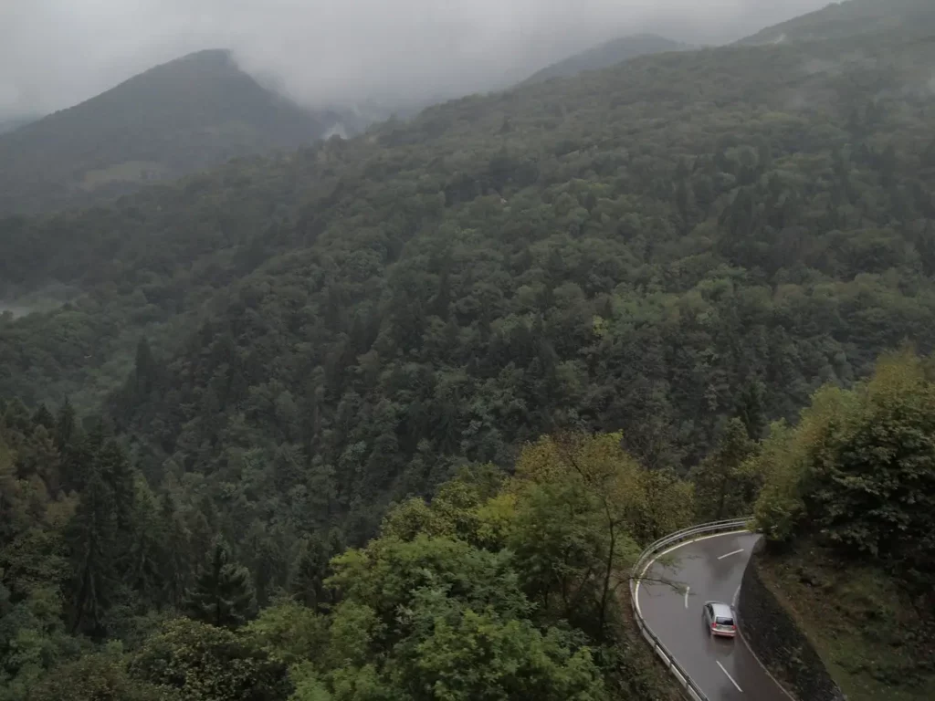
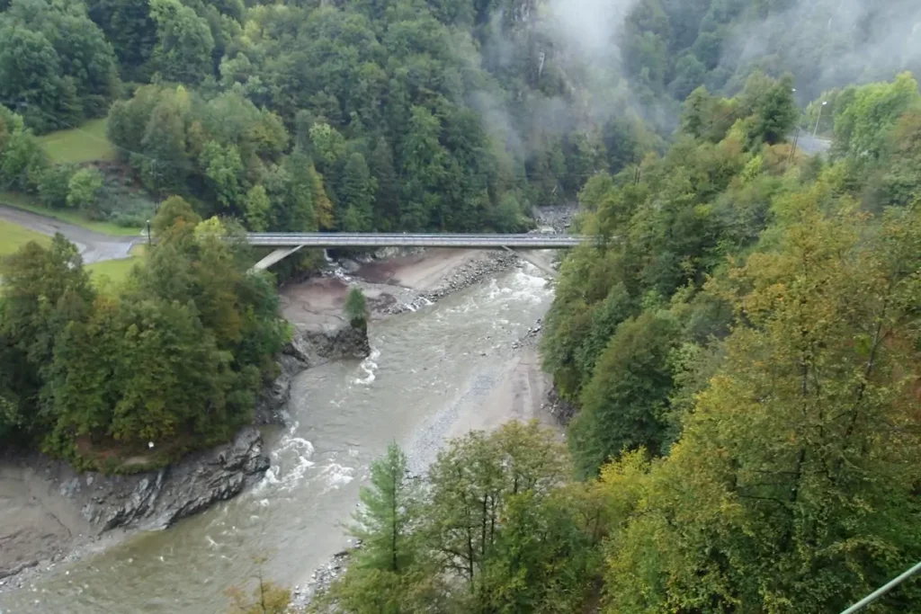
Railway runs along the edge of steep slopes, sometimes driving into small tunnels (24 tunnels) and passing over bridges (79 bridges in total). The train goes slowly between an abyss and a precipice. The villages are hiding somewhere above, above the railroad. Gorge at the bottom is narrow and steep, but at the top it is obviously more convenient.
Many small valleys open in the direction of travel: the name Centovalli (“100 valleys”) fully justifies itself.
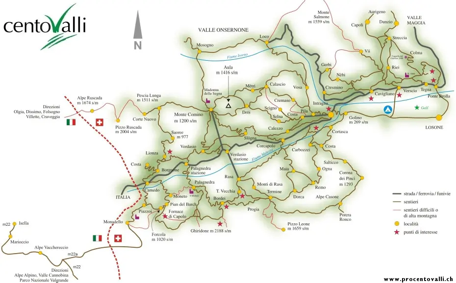
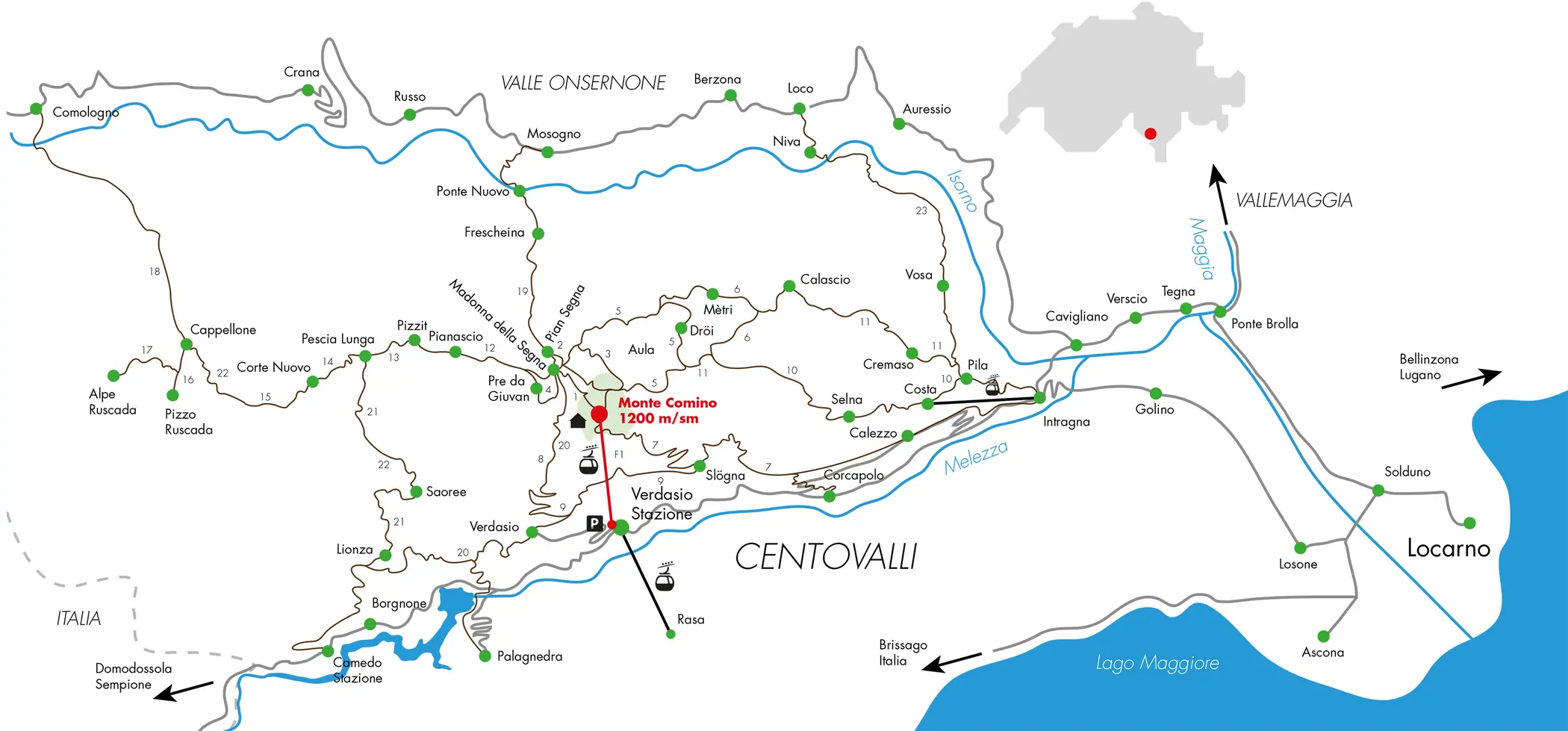
Stops of Centovalli railway
I will briefly tell you about some of the stops, starting from the Locarno side.
The route numbers on the map below are briefly described on the Monte Comino site: www.procentovalli.ch.

Intragna and Corcapolo
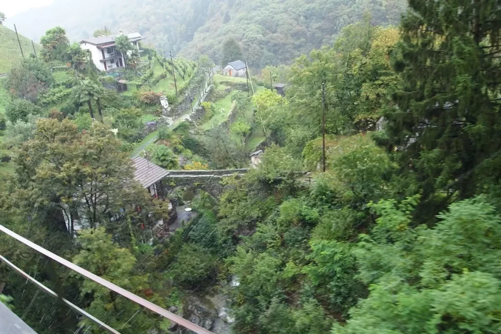
The village of Intragna is located on a hill. Here, a wide built-up valley of several confluent rivers ends unexpectedly and divides into two deep gorges: Centovalli and Onsernone (Valle Onsernone).
The railway bridge to Intragna is perhaps the most popular shot of the Centovalli railway. In addition, in Intragna there is the Centovalli Museum, the highest bell tower in Ticino (65 m), the Pila – Costa cable car.
Between Intragna and the next stop, Corcapolo, is the region’s oldest bridge (1578), called Ponte romano. In shape, this bridge resembles the bridge in Lavertezzo (see the topic about the Verzasca gorge), only made with one arch. Further from the bridge along the path you can climb to the village of Raza. There is a cable car from Verdasio station. The same route can be taken in the opposite direction (5.5 km, hiking time – 2.5 hours).
Verdasio
The Verdasio station is interesting in that there are two cable cars at once to different slopes: to Mount Comino and to the village of Rasa.
Both slopes are interesting and offer various hiking trails. Especially the less steep and apparently less wooded slope of Monte Comino.
Small and picturesque itself, like all local villages, the village of Verdazio is not near the station, you still have to climb to it. One of the most advertised itineraries (a leaflet with a description can be obtained from the tour office) Monte Camino – Intragna. It has several options and lasts from 2.5 to 4 hours. The difference in height from the top point of the Monte Camino cable car to the top point of the cable car in Intragna is 500 m.
Follow me
Palagnedra and Camedo
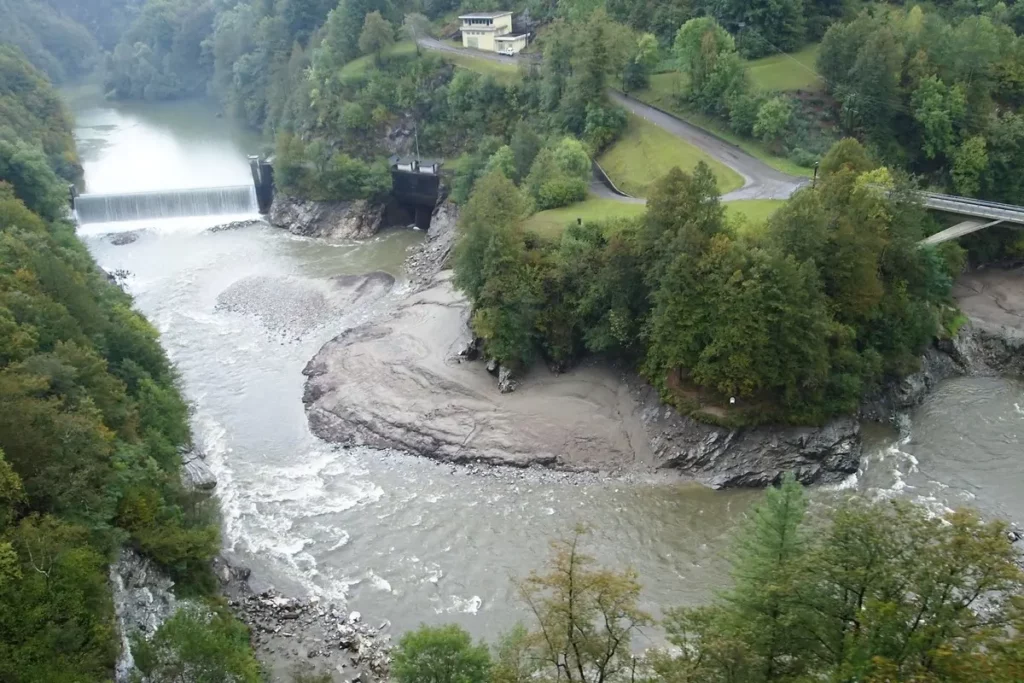
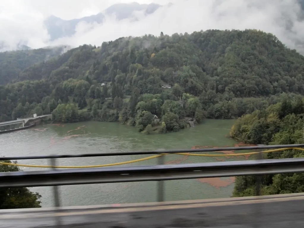
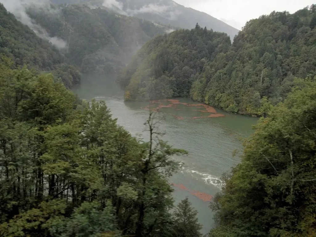
At the Palagnedra station, the reservoir begins – Lago di Palagnedra.
In the village itself, to which you need to climb, there is a church with 15th century frescoes.
The reservoir ends at Camedo. From here another route is a long walk along the gorge from Camedo through Verdasio and other villages to Intragna. The difference in elevation is small, as the mule trail runs almost all the time at the same level. Duration – 5 hours
Italian part
We will cross the border and go to the Italian part. Here’s what I found out.
From Camedo, after a relatively flat section after Verdasio, the railway begins to gain height again. T
he gorge on the Italian part is already called Valle Vigezzo, although the river flows the same – Melezzo (for the Swiss Melezzo).
The highest point is the village of Santa Maria Maggiore. After it, the railway goes down. River is different, although it bears the same name, but flows in the other direction. The gorge in Italian territory is wider.
The most interesting are Re with a large pilgrimage church and Santa Maria Maggiore, next to which (the neighboring Prestinone station) there is a cable car.
It would also be interesting to look at the serpentine railway at the end of the road, where it descends to Domodossola.
Next – Maggia Valley
All posts about #Ticino
Do you enjoy the site without cookies? This means that I work for you at my own expense.
Perhaps you would like to support my work here.
Or change your cookie settings here. I don’t use personalized ads