Last Updated on 07/10/2023
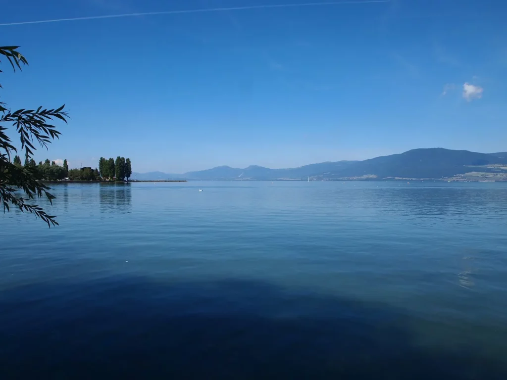
Neuchâtel Lake is the largest inland Swiss lake, a paradise for watersports and bird lovers. For the former, numerous campsites are provided, for the latter – protected areas along the entire eastern coast, which begin immediately beyond the borders of a few and small settlements.
The lake is divided by several cantons (quite funny, there are even exclaves and enclaves: Vaud, Friborg, Neuchâtel and a bit of Bern). This is very inconvenient when preparing, since the sites of each of them try to talk more about their sights, although they can be quite far away from the lake, and less mention of the sights of other cantons, although they are within easy reach.
Around Lake Neuchâtel – what to see: Neuchatel, Biel, Murten
South of Lake Neuchâtel map
Fribourg,
Gruyer,
caves of Vallorbe,
Canton Valais. Sion – castles and bisse canals
Bern
Lake Geneva
The eastern coast is lower, but nevertheless hilly, the western coast is the high slopes of the Jura mountains. Large cities – Neuchâtel, Yverdon-les-Bains, Estavayer-le-Lac. In the first two, we were not, because according to the photographs, it was Estavayer that looked the most beautiful and we rented accommodation in it.
Estavayer le Lac
How to get to Estavayer
Estavayer is located next to the autobahn to Lausanne. A fairly high-speed road goes through Payerne to Fribourg (it is faster way to Gruyeres).
The train connects Estavayer with Fribourg and Yverdon. Trains run in each direction once an hour, occasionally twice an hour. The main transfer points are Payerne and Yverdon. To Fribourg – 40 minutes, to Yverdon – less than 20 minutes, to Lausanne – 1 hour 20 minutes (1 change), to Vallorbes – 1 hour 15/35 minutes (1-2 changes), to Murten – 20 minutes (1 change) .
A little history
People settled here in 9-6 millennia BC. The water level in the lake changed periodically. So, in the 19th century it went far from the walls of the city, and the piles of ancient settlements became visible. During the Roman era, the water level was high and people settled on the hill.
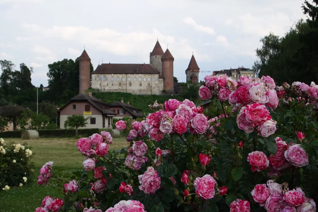
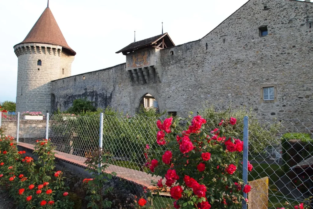
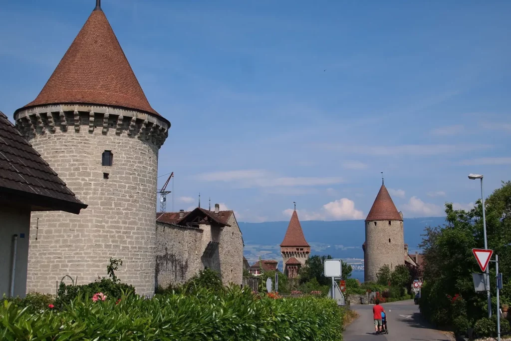
The first Estavayer castle has been known since the 12th century. Three families of Estavayers ruled the city together and built three castles: Motte-Chatel, Schloss Chenaux and the “savoy fortress”. Of these, only the second is completely preserved.
The first walls appeared around the city in the 13th century, the main part of the fortifications was made in the first half of the 14th century.
From the 15th century the city fell under the rule of Fribourg. From the 16th century, when the cities in the north of the lake converted to Protestantism, trade with them ceased, and the population gradually became poorer.
Estavayer le Lac sightseeing
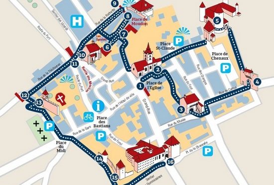
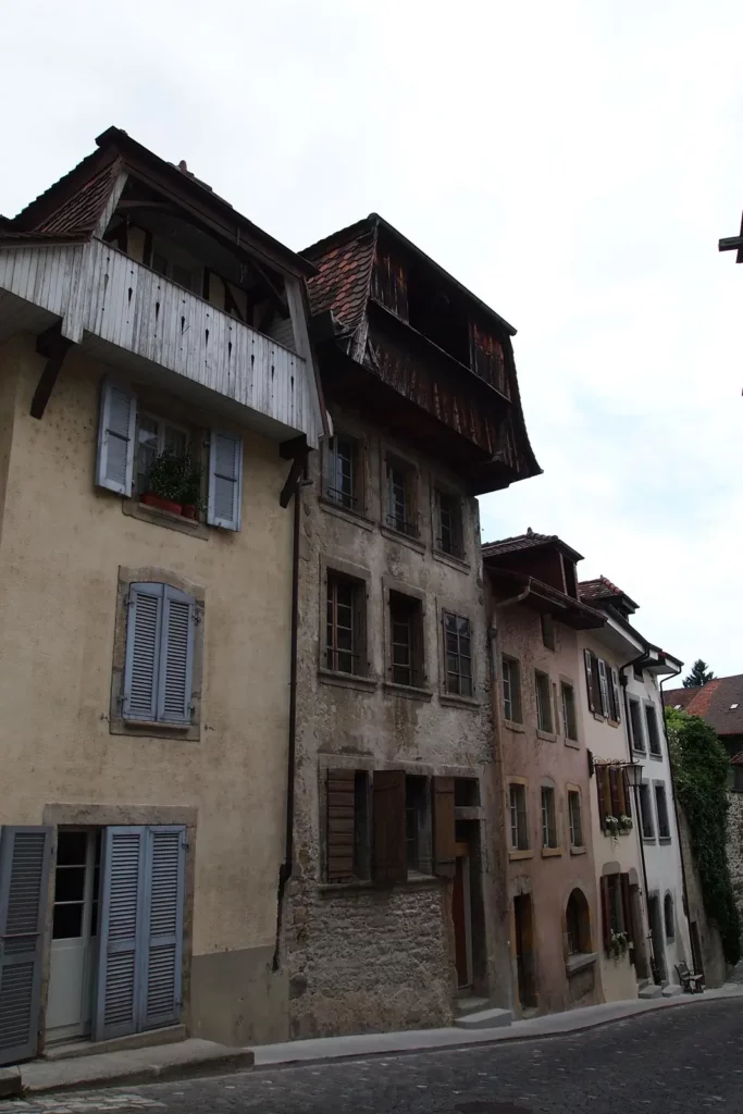
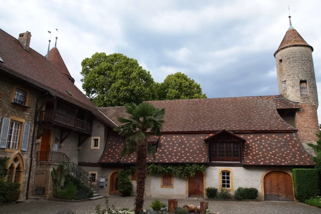
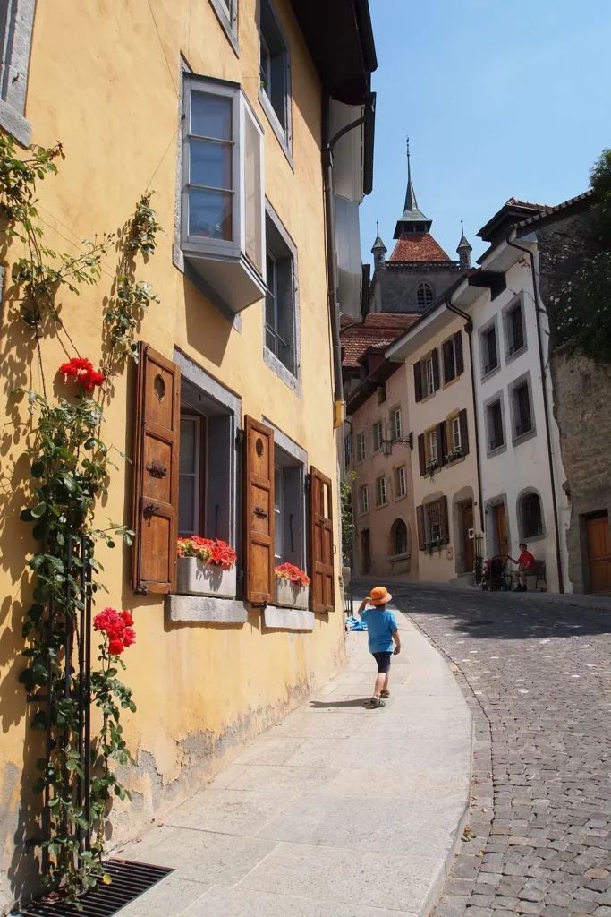
Actually, the main attraction is the medieval city itself. If you’re staying here, look for booklets with detailed maps at the tourist office, showing not only the main streets, but also the dotted stairs leading to the shore and passages in the reeds.
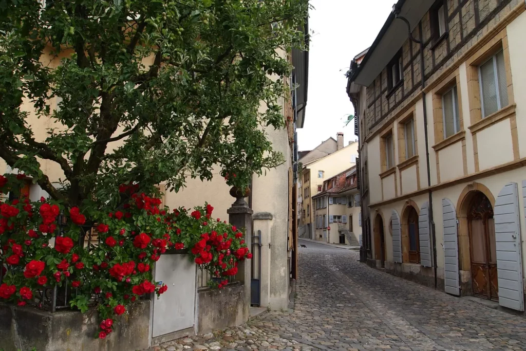
The city makes a very pleasant impression with its well-groomedness, the feeling of antiquity, the absence of a large number of people and the abundance of roses. The rose flaunts in the center of the city coat of arms, on the streets of the city, near the fortress walls, in private gardens and front gardens.

You can walk around the center in an hour or two. The official small plan is quite convenient and does not miss anything.
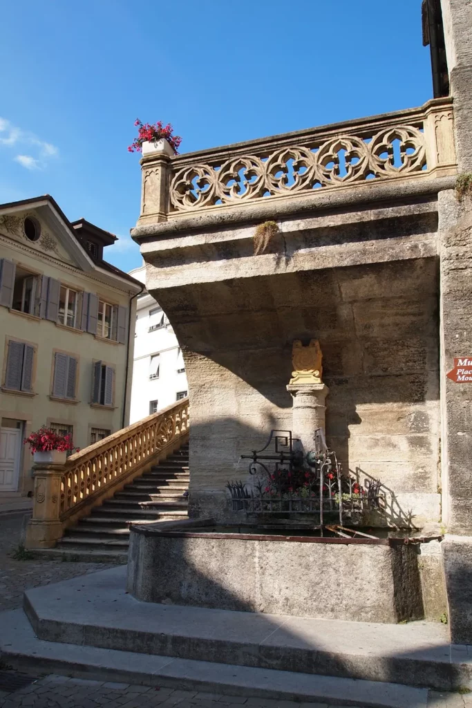
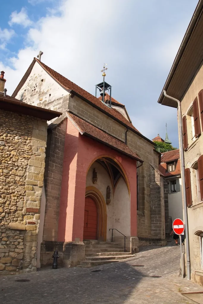
Let’s start, as suggested, at the church. Church of St. Laurent (Late Gothic, 14th-15th centuries). It is interesting with carved choirs and the only 16th-century organ in Switzerland. The fountain under the stairs is also from the 16th century.


We pass along the lane to the “tithe” house – Zehnthaus (House de la Dîme, 3). Before becoming a “tithe” house, the building served as the residence of one of the rulers of the city. This is one of the best preserved city houses, despite its considerable age (1405).
Now there is a frog museum here – 108 frogs were created in the middle of the 19th century and depict scenes from the life of that era. In addition to them, the museum also has weapons from the Middle Ages to the 20th century, various historical and archaeological exhibits, toys, paintings, church utensils – everything that a decent local historical museum should have.
From here we will go to the gate in the city walls.
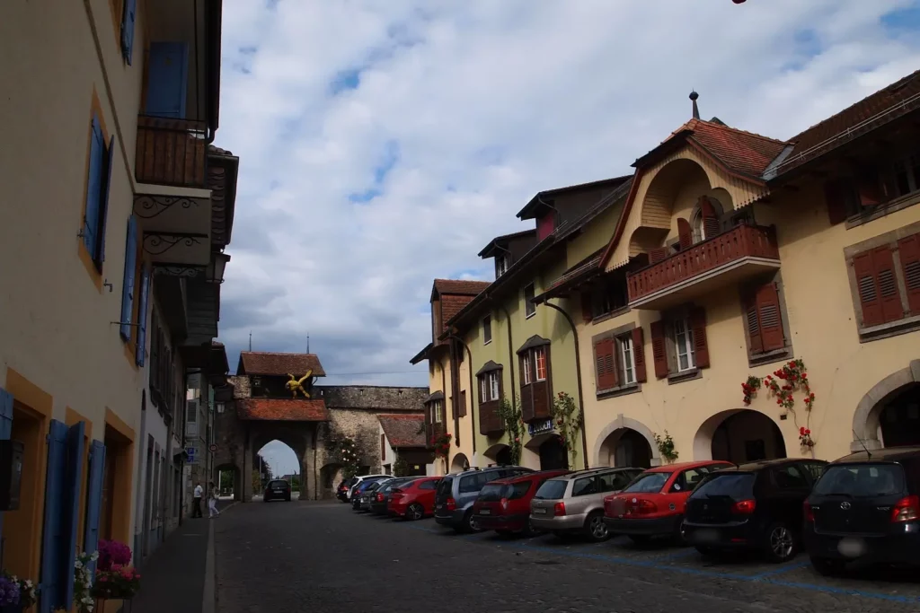
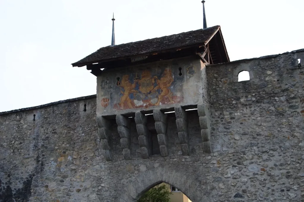
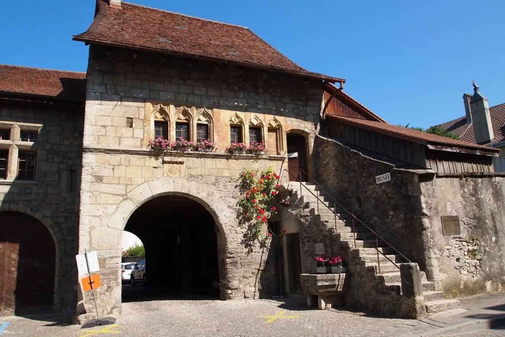
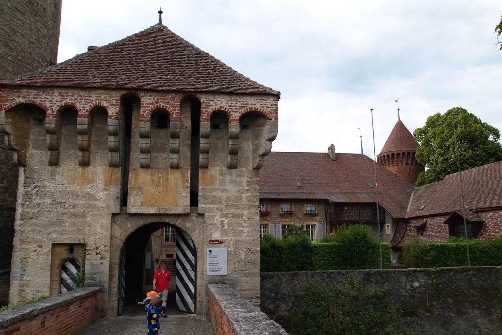
The Grancour Gate (4) was built in the middle of the 14th century. In the 17th century added coat of arms of Freiburg.
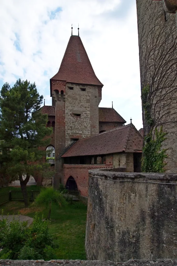
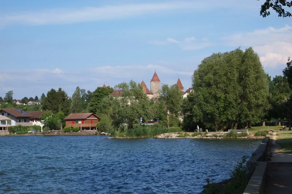
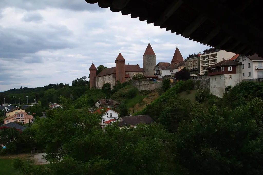
Chenaux Castle
From the gate, a stone’s throw from Chenaux Castle (5). The castle was built at the end of the 13th century according to the Savoy model – in the form of a square. Now there is the city administration in the castle.
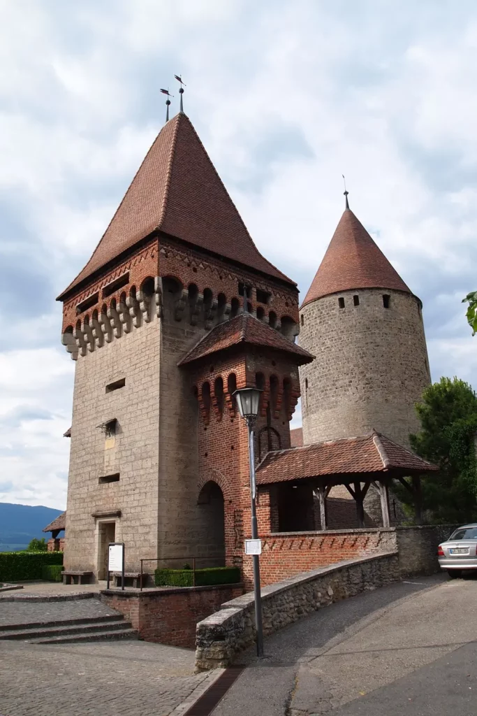

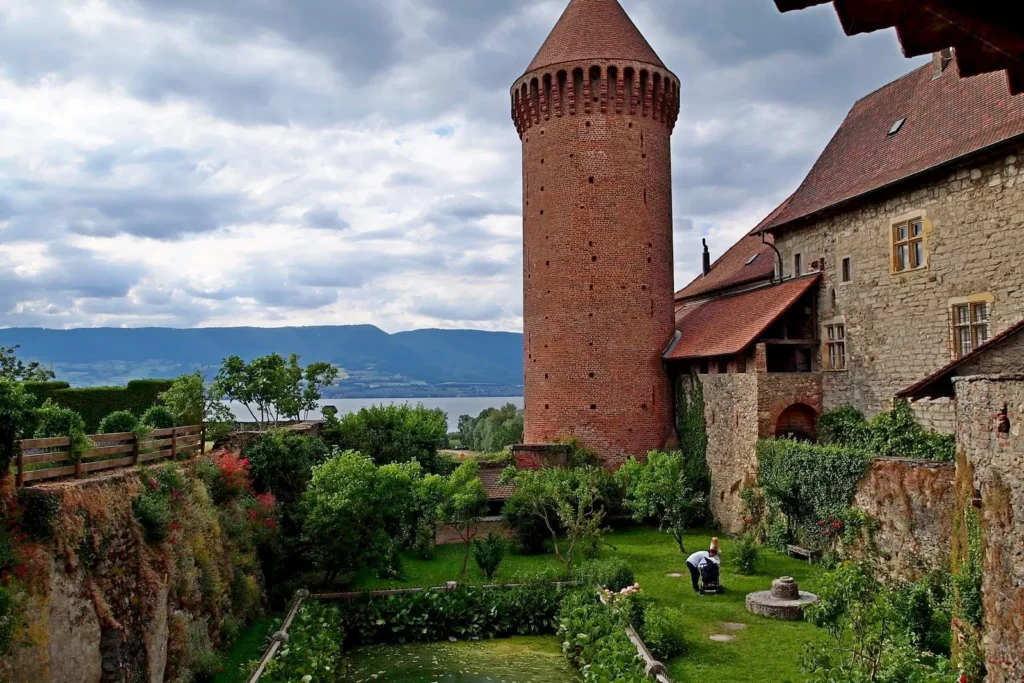
The castle can be walked around in its entirety: a cunningly hidden staircase in the courtyard leads to the outer wall.
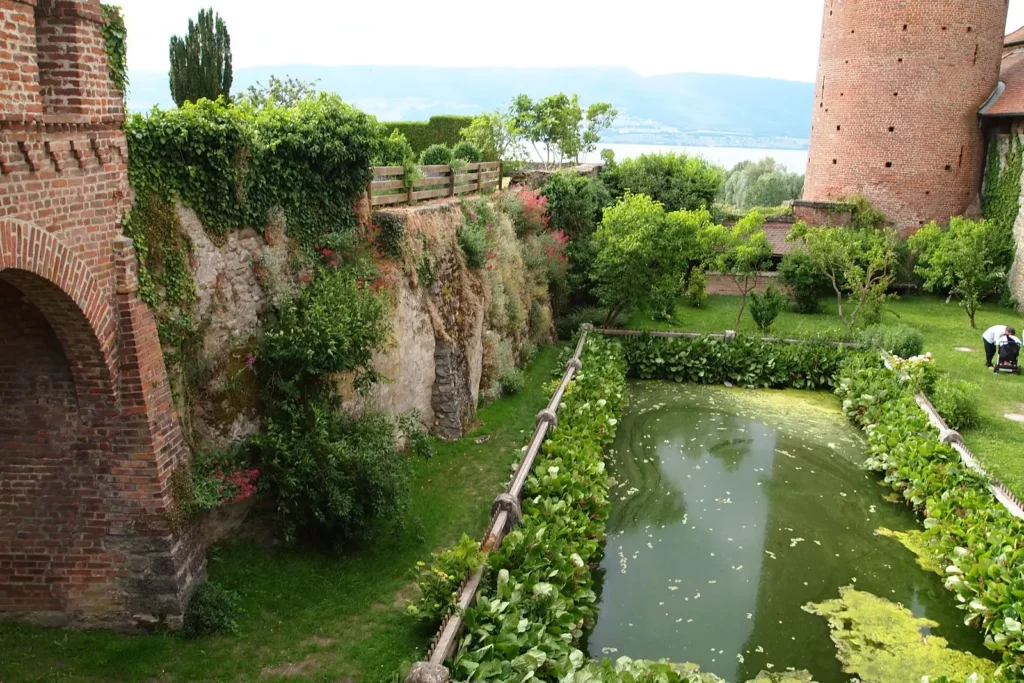
Another inconspicuous passage-descent down begins almost at the castle itself: a narrow path around the house will lead to an observation deck, from where a steep staircase goes down.
Not very detailed plans show only the main entrances to the lake. In fact, there are much more passages to it: sometimes you need to go along a path cut in the reeds, sometimes go around the house on the lawn – actions that are not the most obvious for us.
After a walk along the lake, we will return back to the city, but we will not go to the secret passage to the castle, but to the observation deck on Moudon Square (8). A “secret” staircase, not marked on most plans, also leads here.
Moudon Square was once part of the fortifications of the Motte-Chatel castle adjacent to it, and there were houses on it. It was named after the family from which the city bought the buildings to create the city square in the 16th century.
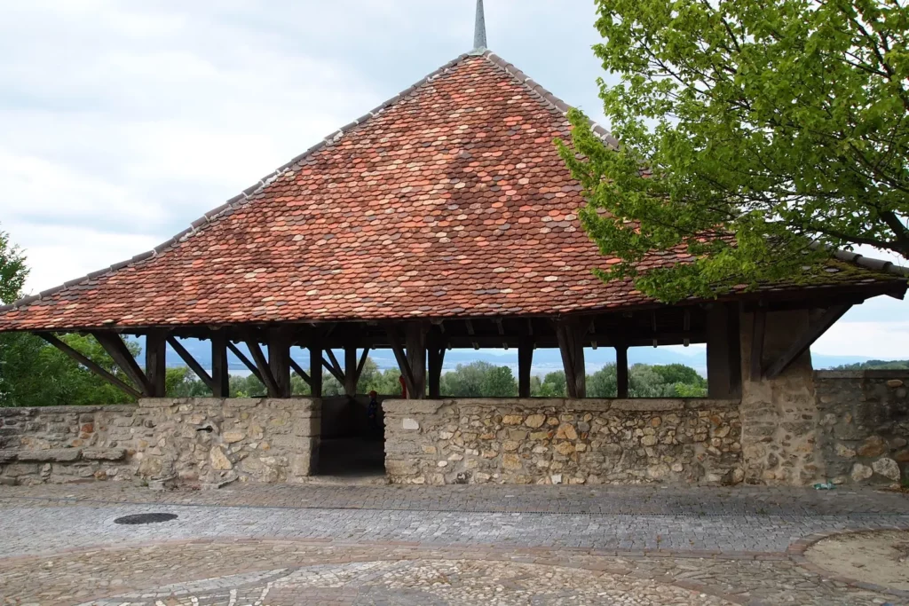
The first thing you see when you enter the square is a mighty linden tree. And it was planted at the same time when the square was created, that is, in the 16th century! Nearby is a roof of a strange shape: if you don’t read the guidebook and don’t go down, then you will never guess that this is not a strange-looking pavilion, but the roof of a tower called the Schützenhaus (1547) and used to train shooters. They fired at targets that were under castle. From below, the tower is hidden behind the trees, so it is also not visible from the shore.


Another historical building is located next to the square – the so-called Maison des Sires (7). It was already built in the 14th century by one of the ruling families as their new residence. If you do not look closely, it looks like an ordinary house, only the semicircular arch of the entrance attracts attention.
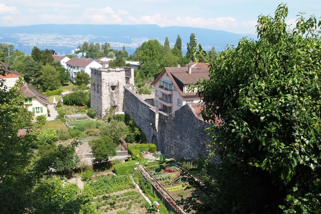
Further, the plan proposes to go down the Ergalets passage (narrow picturesque stairs) down and see part of the city wall (12, 13). An alternative, no less picturesque descent is Grand Rue. On the way there will be a small chapel von Rivaz (number 10, 1488), nearby – Mill Lane (11): once a stream passed here and mills worked.
Next stop is the Thiolleyres gate, part of the city walls built in the early 14th century to protect the harbor. Parallel to the wall, another staircase goes up, nearby the waterfall of the Mill stream rustles.
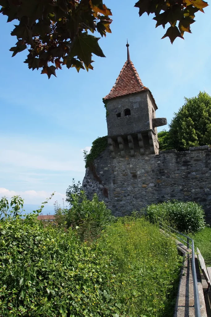
Then the walk continues along the city fortifications past the Lombard Tower (15th century, number 14), the Savoy Tower (end of the 13th century, number 15) to the Dominican monastery. Dominicans have lived here since the early 14th century and are living still. The monastery was almost completely rebuilt in the 17th-18th centuries.
Having walked around the monastery, you can return to the center and try fried horse meat in one of the few local restaurants (for some reason, a very popular dish of the region, there is almost every restaurant).
Neuchatel Lake boat trips
Pleasure boats rarely cross the lake. Most often they run in the part where Neuchâtel is located, along a short route to the opposite bank and back. Ships appear in Estavayer about 4 times a day. The schedule is built on the principle: left in the morning (right or left), returned in the evening.
Travel time to the ends of the lake (Yverdon or Neuchâtel) is an hour and a half. Sometimes a paddle steamer runs along the lake, it has a special schedule.
Since there are two more lakes – Murten and Biel – very close to Lake Neuchâtel, and they are connected by canal rivers, the local shipping company arranges trips “Two Lakes” or “Three Lakes”.
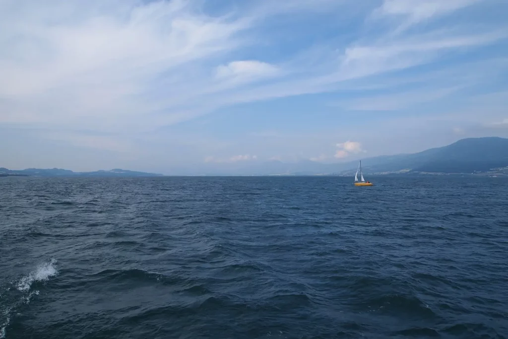
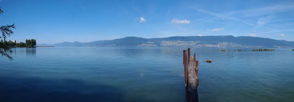
Lake Neuchâtel cannot be called particularly beautiful in terms of landscape: it is rather monotonous, there are no cities or mountains that look particularly beautiful from the water.
Let’s look clockwise.
South, Yverdon
West
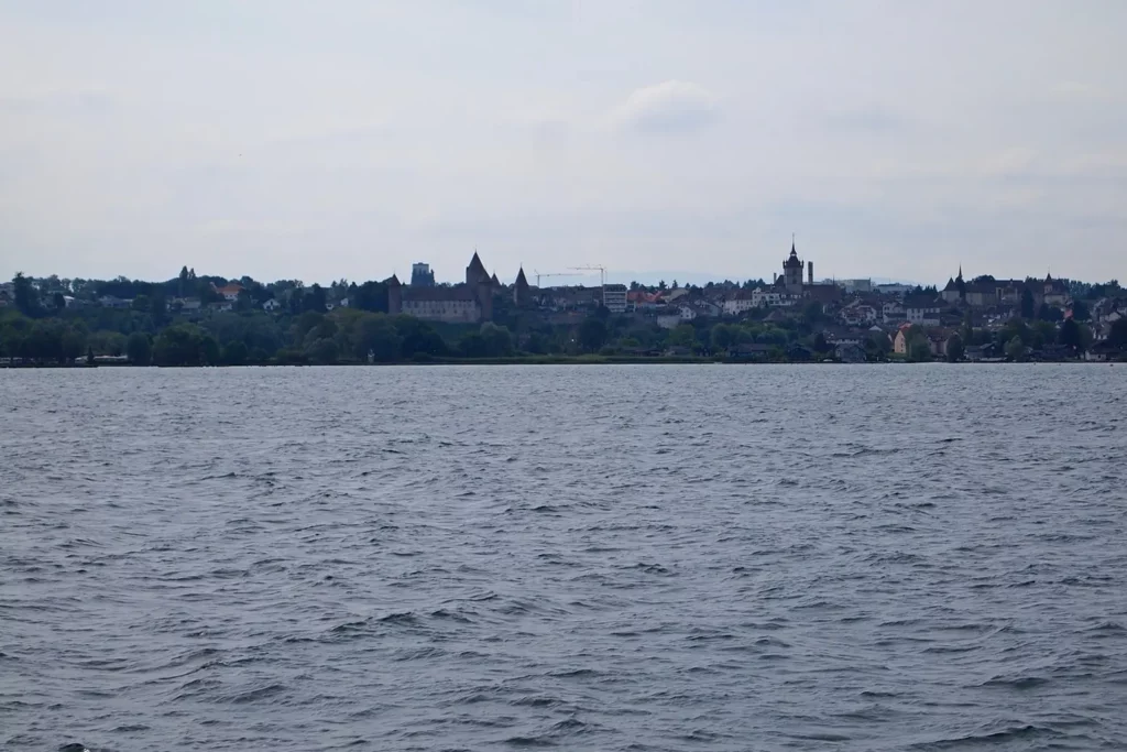
North, Neuchâtel
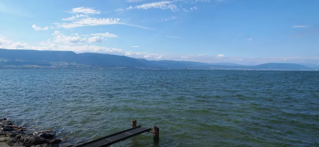
East, Estavayer from the water.
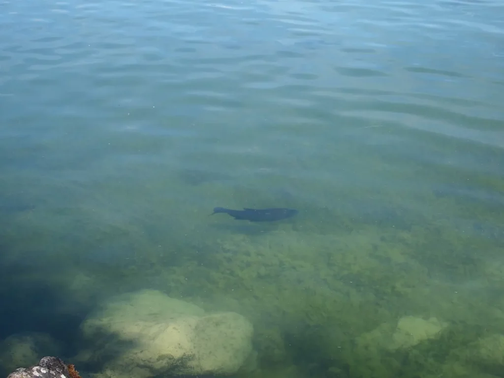
However, there are crystal clear waters and in some places wonderful sandy beaches, almost dunes.

Follow me
The Broje canal river, which connects Lake Neuchâtel with Lake Murten, is short and calm. Boating along it is not too boring (since it takes about half an hour), but it is not exciting either.

Lake Murten is more picturesque, perhaps because of its not too large size and the city itself, beautifully located on a high bank above the lake.
As a bait, the shipping company uses free Internet (very slow, password must be asked from employees) and the ability to transport bicycles for free.
Around Lake Neuchâtel – what to see: Neuchatel, Biel, Murten
Topics on the #French part of Switzerland.
Do you enjoy the site without cookies? This means that I work for you at my own expense.
Perhaps you would like to support my work here.
Or change your cookie settings here. I don’t use personalized ads


. 1. Lake Überlingen")