Last Updated on 26/02/2023
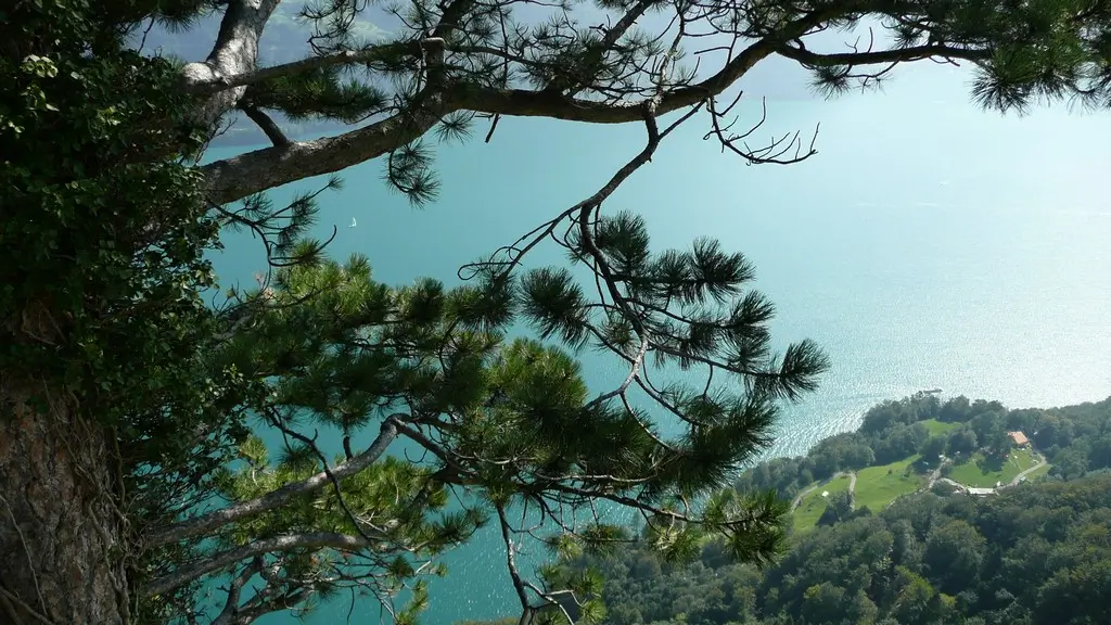
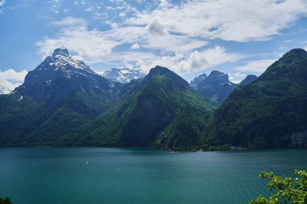
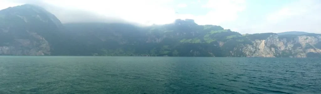
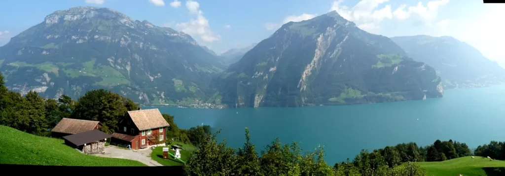
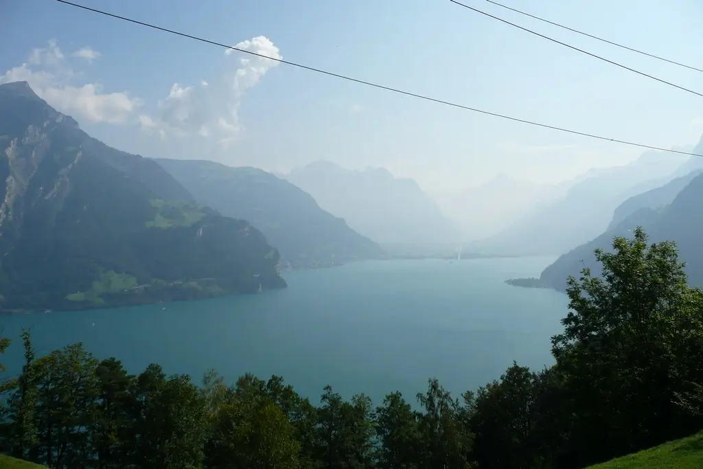
Lake Uri (Urnersee) is the most beautiful part of Lake Lucerne, with emerald waters and surrounding high mountains. This part is at the same time the historical heart of Switzerland, from where it actually began.
about Lucerne
Lake Lucerne. 1. Brunnen, Schwyz
Lake Lucerne. 2. Swiss trail. Lake Uri
Lake Lucerne. 3. From Seelisberg to Stans
Lake Lucerne. 4. Pilatus mountain
Jungrau region. 7. Ballenberg
Lake Lucerne. Map of attractions
all posts – #Lake Lucerne
How to get
The railway runs along Lake Uri on the left bank through Brunnen, Sisikon, Flüelen and Altdorf to Saint Gotthard.
On the opposite side of the lake there is a bus from Flüelen to Bauen and from Stans to Seelisberg (opposite mountain, across the lake from Brunnen). Seelisberg can also be reached by a cogwheel train from Treib pier.
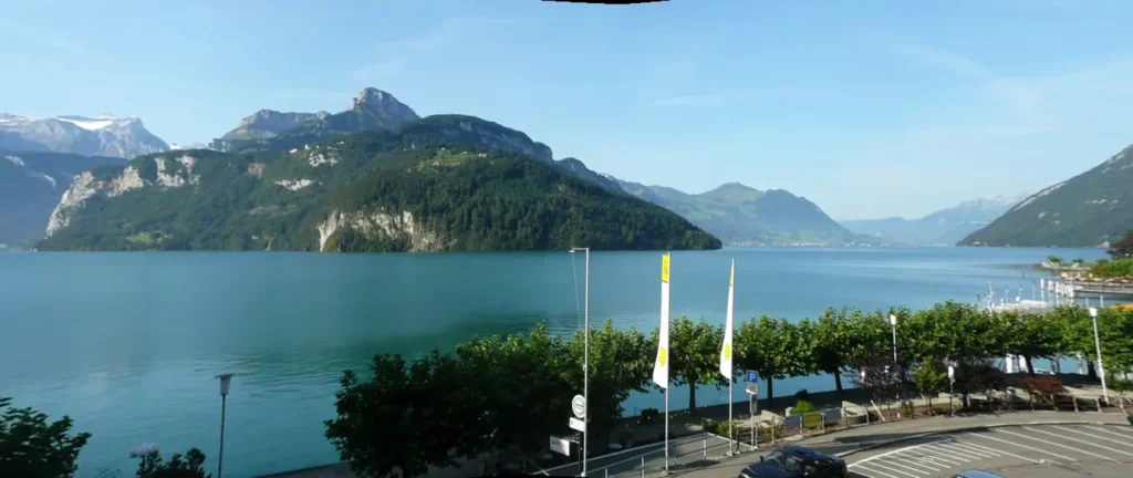
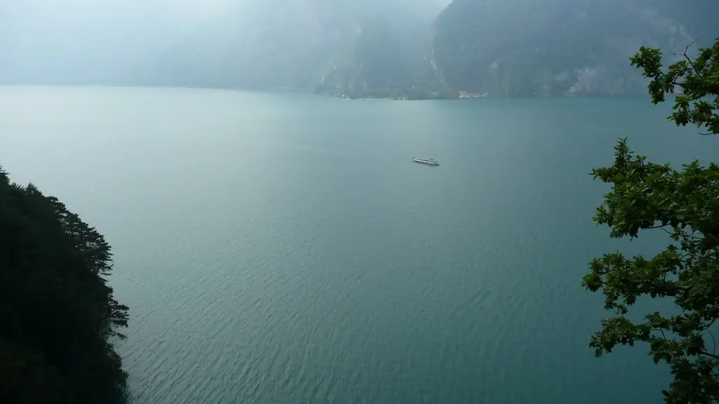
Both large ships (they do not stop everywhere) and small ones with all stops go along the lake. A strong south wind often blows along the lake, which is called a foehn here, so there are many yachts and windsurfs here.
Swiss trail
In 1291, on the Rütli meadow (on the opposite side of the lake from Brunnen, visible from the embankment), representatives of the three cantons (Schwyz, Uri and Unterwalden) swore an oath to jointly defend against the invaders. Invaders at that moment were the Habsburgs. This is how the Swiss Confederation was born.
Here Lake Uri beginns. On the photo Seelisberg from Brunnen. The funicular lifts up. Below is Ryutli’s meadow
In honor of the 700th anniversary of this event, the Swiss trail (Weg der Schweiz) was created in 1991. This is a hiking trail around Lake Urnersee that ends in Brunnen. The 35 km route is divided into pieces according to the number of cantons. The length of the segments corresponds to the number of inhabitants in the canton. Part of the route passes at the level of the lake (Flüelen – Bauen), and part above it (Brunnen – Sisikon, Bauen – Seelisberg).
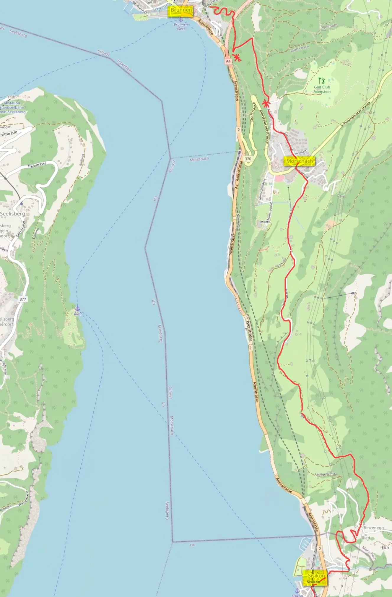
Section Brunnen – Sisikon
Let’s start from Brunnen. The first section is from Brunnen to Sisikon. The trail starts from the stairs at the Ochsen Hotel.

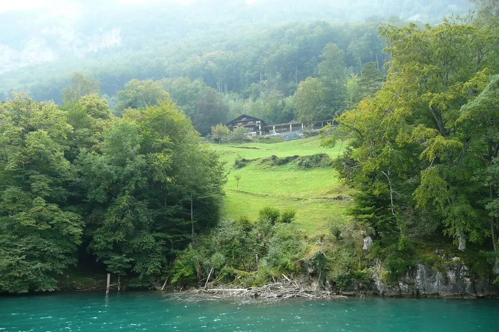
First you need to go up to Morschach. In the village, look at the lake from the observation point and go down to Sisikon (about 3 hours, the elevation difference is about 390 meters, you can make your life easier and go up to Morschach by bus).
Sisikon is an unremarkable small village between the autobahn and the lake.
You can safely skip this section especially if you have been to Fronalpstock or Urmiberg.
Brunnen and the first section of the trail from the opposite bank (on the right)

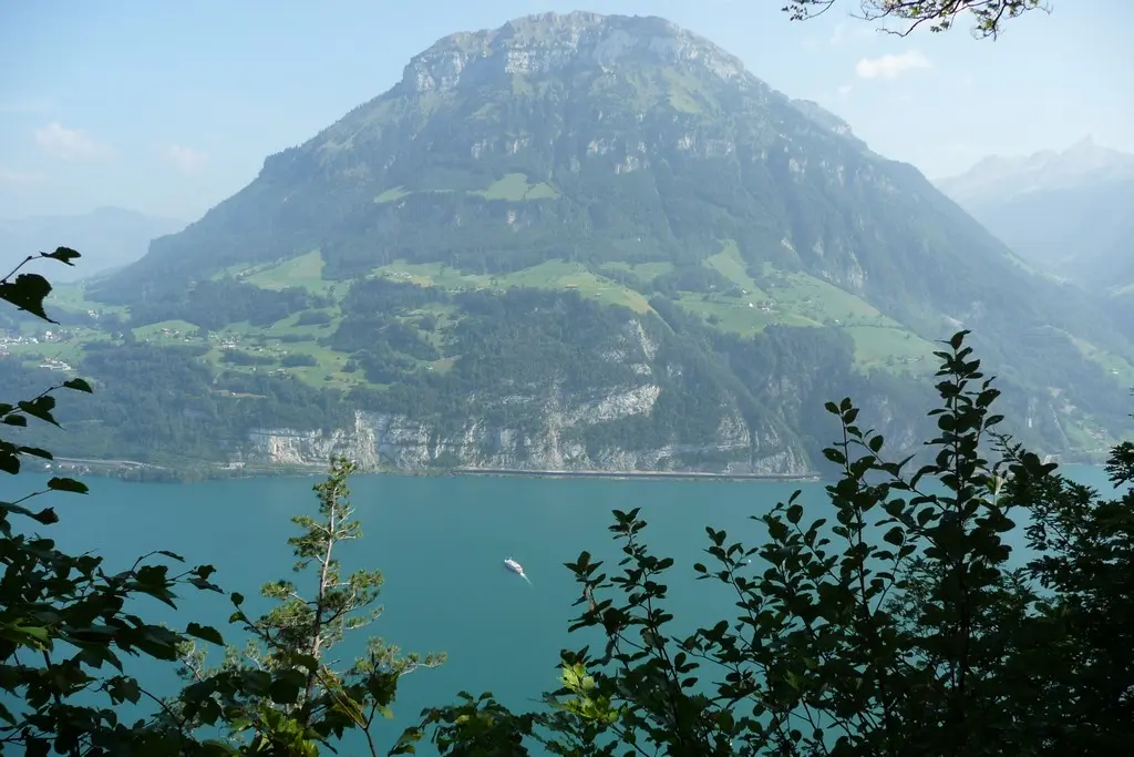
Fronalpstock from the opposite bank and Sisikon below
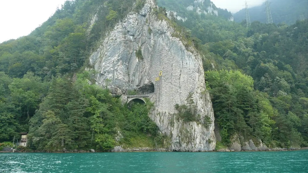
Section Sisikon – Tellsplatte
Then the trail goes to Tellsplatte. First, the ascent is 75 meters, then the road goes along the shore of the lake (about an hour). Tellskapelle is near the Tellskapelle pier.
The Swiss and especially the locals make the most of the legend of Wilhelm Tell. Near the place where the chapel was built, according to legend, Wilhelm Tell managed to get out of Gessler’s boat.
The chapel has existed on this site since 1388. Modern building dates back to the end of the 19th century. The murals were done by Ernst Stückelberg.
Follow me
There is a very interesting “bell tower” above the chapel. In 2001, the Swiss chocolate makers sponsored a structure consisting of bells interconnected and playing about 15 tunes. Anyone, if he comes here in the first 10 minutes of every hour, can choose from the presented melodies, press a button on the control panel and listen to the bell ringing. Especially, as it seemed to us, the creators succeeded in Papageno’s aria from Mozart’s The Magic Flute.


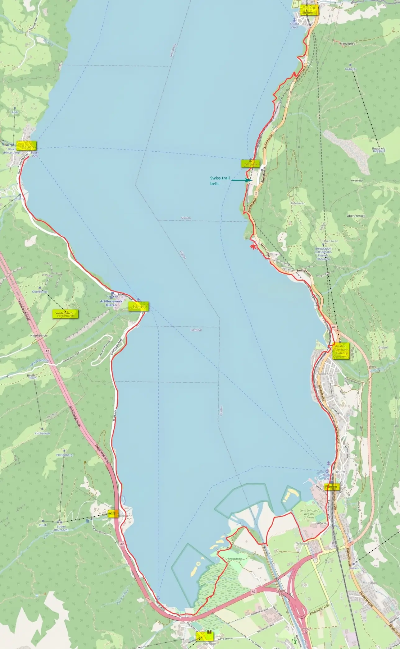
Section Tellsplatte – Flüelen
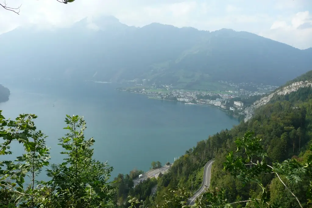
One of the most picturesque section of Swiss trail starts from Tellsplatte (Tellsplatte – Flüelen, 1.30 – 2 hours). Climbing up to the level of the Autobahn, the hiking trail follows the old road (Alte Axenstrasse), carved into the rock. Emerald water is somewhere sooo far underfoot, wonderful views of Flüelen and the mountains (if we are lucky with the weather, we were not very lucky). Then the trail goes down by stairs (but not to the water level). But you can also walk along the asphalt pedestrian / bicycle road along the Autobahn.


Flüelen and Altdorf
Flüelen is a town on the way to Saint-Gotthard. A little further inland is the main city of the canton of Uri – Altdorf. It was here that, according to legend, the conflict between William Tell and the bailiff Gessler took place.
In the center of Altdorf there is a monument to Wilhelm Tell. The sights include the Town Hall, the Capuchin Monastery, the Uri Canton History Museum, the swimming pool and the cable car at Eggberge. Not far from Altdorf there is the village of Bürglen, where Wilhelm Tell was born and where there is a museum dedicated to him.
Wilhelm Tell
According to legend, the peasant Wilhelm Tell from Bürglen, a famous archer, went with his son to the town of Altdorf to the fair. Gessler, the newly appointed governor of the Habsburgs, hung his hat on a pole in the square, to which everyone was supposed to bow. Tell did not do this. For this, Gessler ordered his son to be taken and suggested that Tell shoot down an apple from the boy’s head with an arrow. Tell took one arrow, put the second in his bosom. His shot was successful. Gessler asked why the second arrow was needed. Tell replied that if his son had died, the second arrow would have been for Gessler.
Tell was arrested and taken on Gessler’s ship to his castle in Küssnacht. At this time, a storm broke out on the lake, Tell was unleashed to help save the boat. Tell jumped out of the boat at the place now known as Tellsplatte and went to Küssnacht. When Gessler arrived there, Tell shot him on a narrow road. Tell’s act inspired people to revolt against the Austrians, in which Tell played the role of one of the leaders. Representatives of the three cantons (Uri, Schwyz and Unterwald) took the legendary oath of mutual assistance on the Rütli meadow in 1307. According to legend, Tell died in 1354 trying to save a drowning child
The first written sources documenting the legend of William Tell date back to the 15th century. (White Book of Sarnen, 1475). For a long time, the legend was considered a historical event, later, in the 19th-20th century, it was confirmed that the formation of the Swiss Union dates back to 1291. The legend of Tell inspired Goethe during his travels in Switzerland. He wanted to write a play about it, but then passed the idea on to Friedrich Schiller, who in 1804 wrote the play William Tell. Rossini used Schiller’s play as the basis for his opera William Tell.
Section Flüelen – Seedorf
The next section is Flüelen – Seedorf – Isleten, 2 hours. This section is not burdened with any elevation differences or special views. But it is suitable for those who find it difficult to overcome forest roads and large climbs.
In Seedorf you can see
- the Benedictine monastery of St. Lazarus, founded in 1200 (building of the 17th century),
- a tower of the 12th century,
- a small house-castle Pro Castle, built in 1556 by a family who became rich in the sale of wine and grain. Now the castle is a museum of mineralogy.
Section Isleten – Bauen
Most of the way from Isleten to Bauen (40 min) passes through a tunnel with cut windows. The creator of the Swiss national anthem was born in Bauen. A monument to him is erected here. The village itself is very small as the slope is quite steep. The climate here is almost southern. In the village you can see dates, bananas and palms.
This section from other side of the Lake Uri.
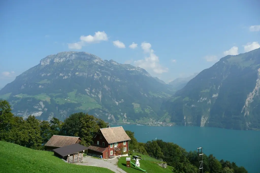
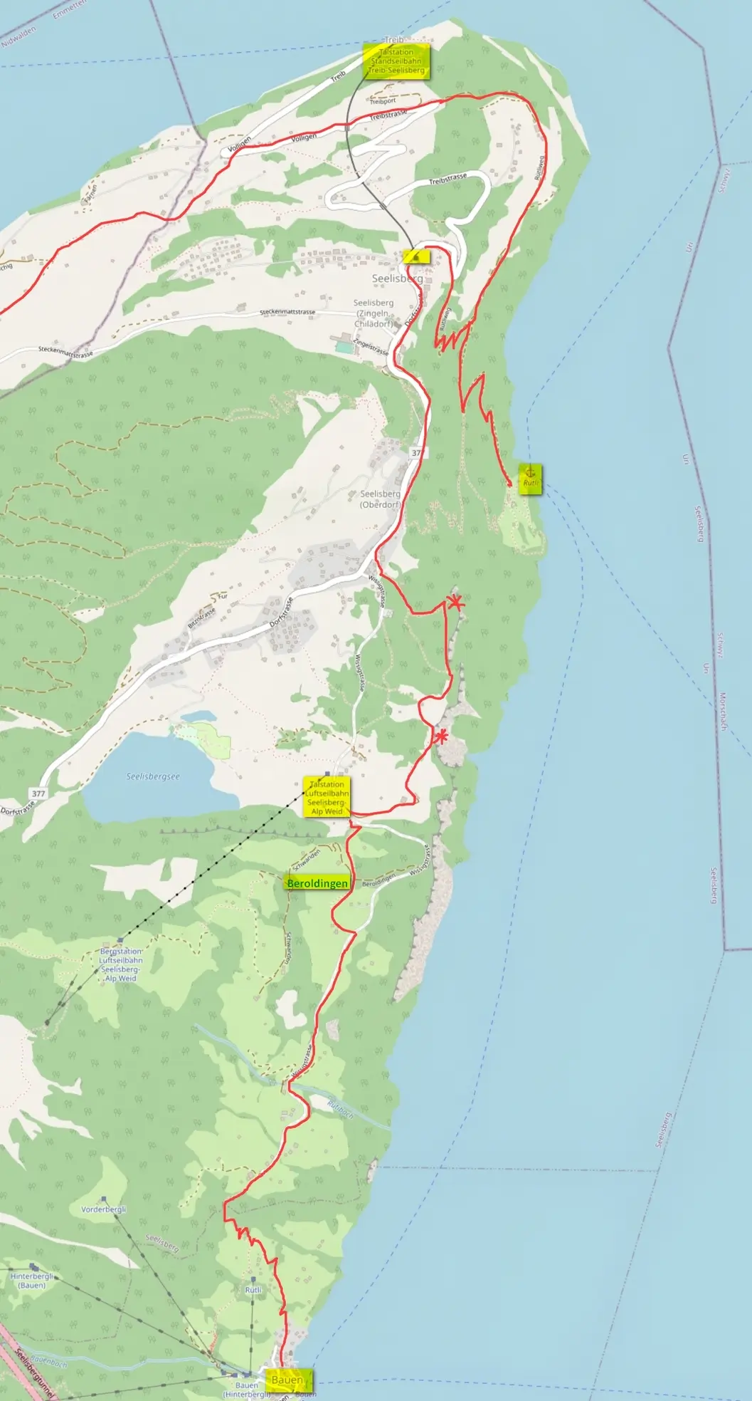
Section Bauen – Rütli
From Bauen to Rütli (2 hours, elevation difference – 350 meters) – this is another scenic section of the trail.

Its only inconvenience is the 960 steps at the start of the journey from Bauen. To avoid climbing (or descending, which is also unpleasant) along half ruined steps with protruding roots, you can walk from Rütli (Treib) to Beroldingen castle and back to Treib without going down. In Treib, take the funicular down or take the bus to Emmeten / Stans.
This section view from Tellsplatte. The route climbs from the village opposite to the middle of the mountain (the stairs), then runs to the right without much difference in altitude
The highest point of the route is Beroldingen Castle. It stands on the old baggage track from Lucerne to Altdorf and was first mentioned in documents in 1500.
The owners of the castle have controlled the Uri Valley for centuries. To get to the castle, you need to make a small detour, turning off the asphalt road following the signs.
The next viewing point is to Lake Seeli. A small cable car is near her. Such cable cars are periodically found in the mountains. They lead to some small village in the mountains, carry cargo and 4 passengers and do not work regularly.
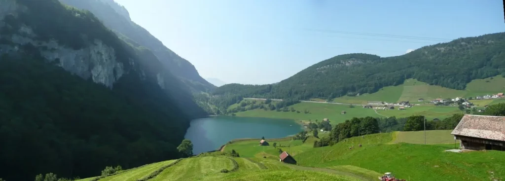
The lake in the hollow between the mountains is occupied by a camping and a paid beach. We did not find, where we can simply sit by the water – for free and far from bathers. Probably, the approach to the water is from the other side of the lake. Therefore, if you are not going to swim, it is not necessary to go down to the lake (and then climb back).
If you do decide to go down to the lake, do not miss the views of the Schiller Balcony observation deck. As due to the detour to the lake you can skip this site.
Schiller’s Balcony observation deck
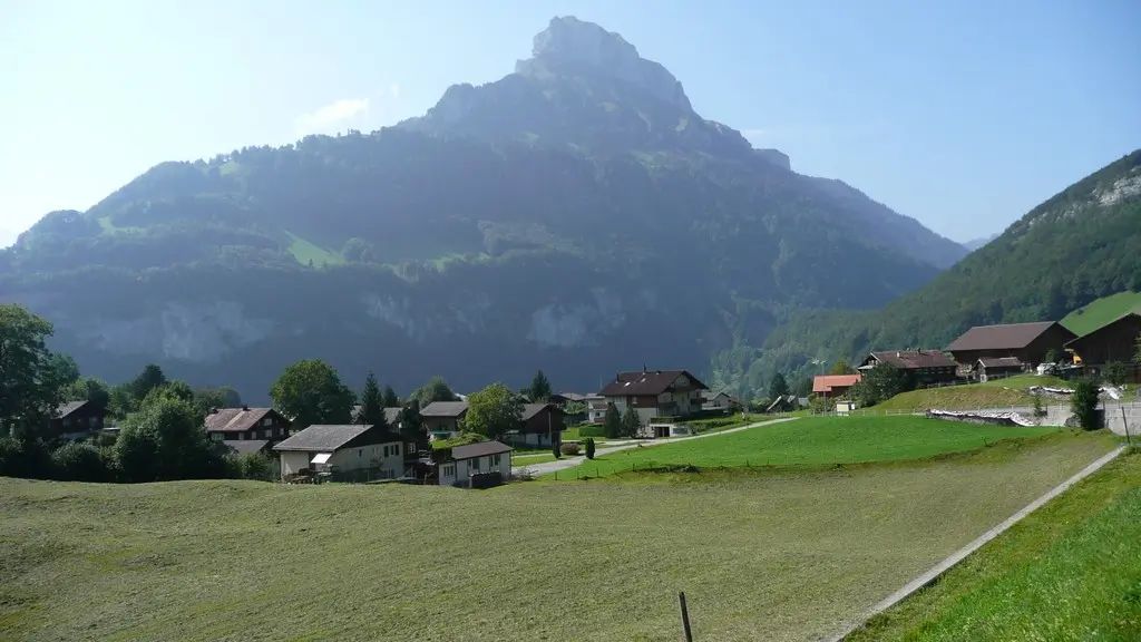
From a small village of a couple of houses, the trail goes through the forest and turns to the very edge of the cliff. From here, a wonderful view of Brunnen and Fronalpstock opens up.
It is named so because from it you can see where the action of Schiller’s drama “Wilhelm Tell” took place.

From here you can go down the steep serpentine straight to Rütli.
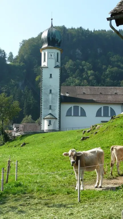
In the village, we went out onto a green terrace with tables, thinking to have a snack. But strange ladies, silently and intently eating breakfast with serious thoughts on their faces, made us doubt whether we got there. As it turned out, a huge hotel, similar to a palace, which can be seen even from Brunnen and from the water, is a hotel for those wishing to join Ayurveda. For just over € 300 a day, you will recover your health and fall into nirvana.
The next attraction is further down the road – behind the church, the Bergkäserei Aschwanden cheese dairy (from May to mid-October from 9.00 to 11.00). There you can taste the extremely unpleasant smelling mountain cheese (Bergkäse).
Treib
Finally, the trail comes to the top station of the funicular from Treib. Here you can go down to Treib and take a ship. Or you can take a bus that goes through Emmeten to Stans.
You can also go down to Rütli and look at the famous meadow, which, in order to save from hotel development, was bought by a public organization and donated to the state. In 1940, Switzerland’s military strategy was published here. The creation of Switzerland is celebrated on the meadow every year on August 1.
In Treib, there is also Haus zur Treib – the hall where the representatives of the Swiss Confederation of 1482 gathered. Now it is part of the hotel, open to the public.
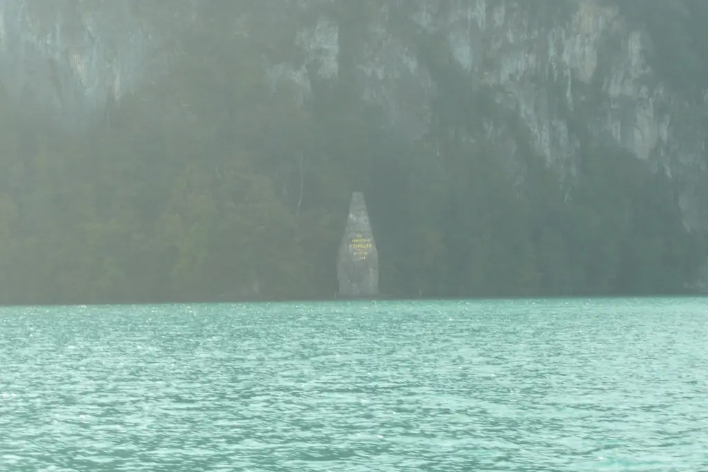
A commemorative inscription dedicated to Schiller is engraved on a stone in the water near Treib, where Lake Uri ends.
Next – other posts about lake Lucerne (Vierwaldstättersee) – #lake Lucerne
Do you enjoy the site without cookies? This means that I work for you at my own expense.
Perhaps you would like to support my work here.
Or change your cookie settings here. I don’t use personalized ads


