Last Updated on 26/02/2023
Сoming to Schwyz and Brunnen you find yourself in the very heart of Switzerland – the place where it originated and where its name came from. Brunnen is on Lake Lucerne, Schwyz Schwyz is a bit further towards Lake Zug.
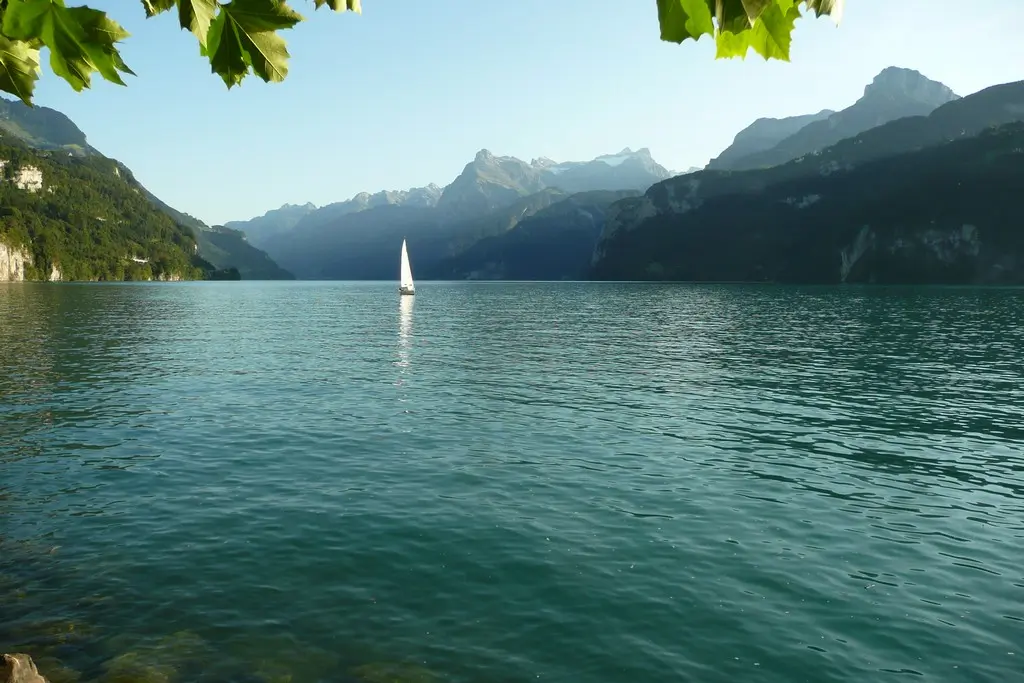
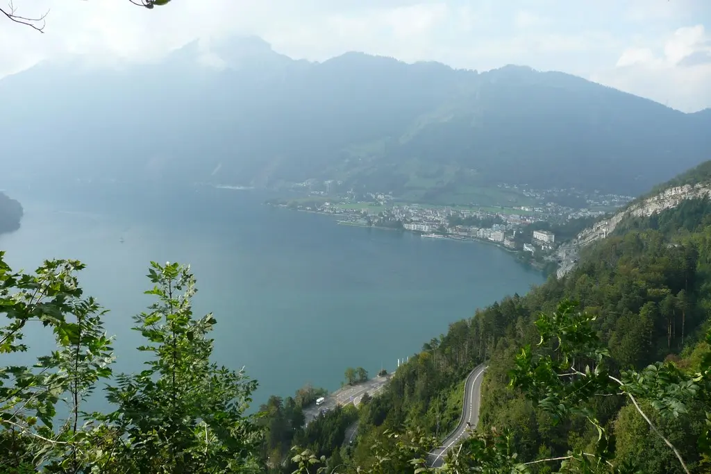
German complex name of the lake Lucerne (Vierwaldstättersee) is due to the fact that its shores were previously divided by four forest cantons (one canton was later divided into two, so now there are five).
The least beautiful part of the lake, in my opinion, is from the side of Lucerne, which gave it its second name. The most beautiful, respectively, from the opposite side, this part has its own name – Lake Uri (Urnersee). Lake Uri beginns from Brunnen.
about Lucerne
Lake Luzern. Rigi, Tierpark Goldau
Lake Lucerne. 2. Swiss trail. Lake Uri
Lake Lucerne. 3. From Seelisberg to Stans
Lake Lucerne. 4. Pilatus mountain
Jungrau region. 7. Ballenberg
Lake Lucerne. Map of attractions
Brunnen
How to get
Railway:
to Lucerne about an hour,
Meiringen – 2 hours with one change,
Titlis – 2 hours with one change,
to Andermatt – 1 hour.
Bus to Schwyz and to Morschach (upstairs village, cable car to Fronalpstock and thermal pool), along the lake to Küssnacht.
Ships – to Lucerne a little over two hours, to Alpnachstad (train to Pilatus) – 3 hours.
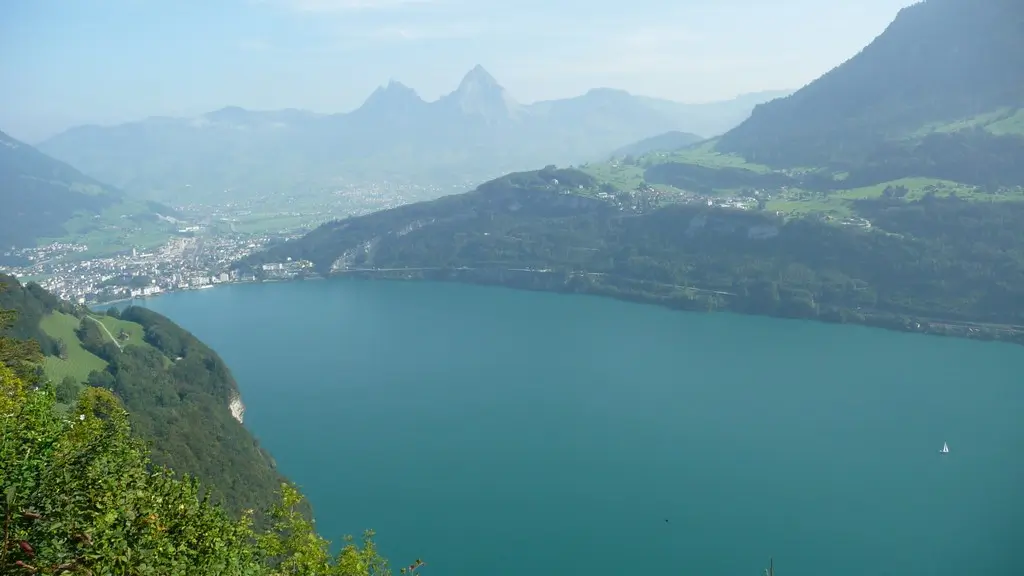
The town is located in the valley of the Muota River, which flows into the lake here. Together with Ingebohl, which merged with it, Brunnen forms a rather large settlement (in the photo, a view from Seelisberg, at the top right – Morschach).
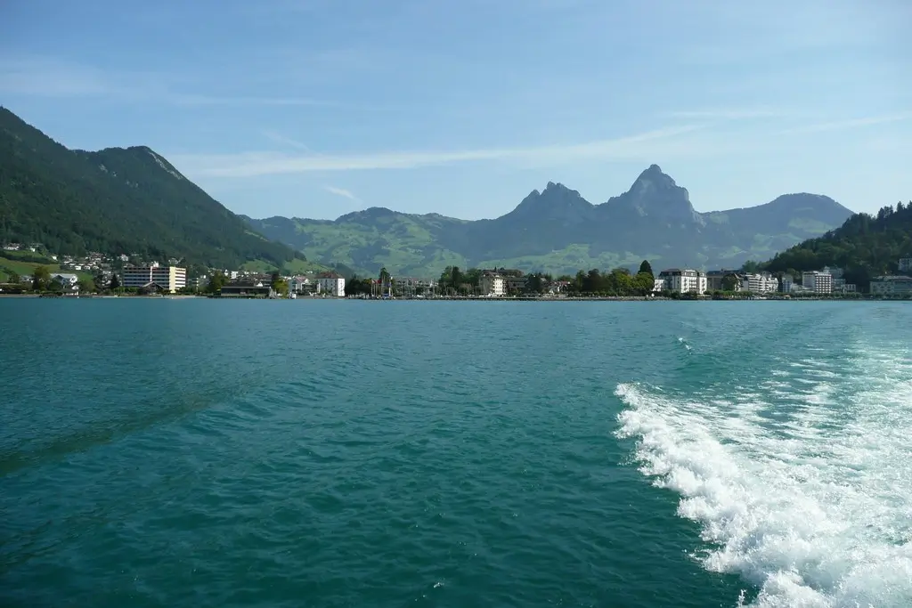
The town itself is quite average, but the view of the lake is wonderful here, and convenient transport links make accommodation here profitable.
Brunnen from the ship. At the background there are “Home” mountains of Schwyz – Großer and Kleiner Mythen. Cable car goes to smaller mountain on the right.
Sights of Brunnen
1. Of the sights there are: Bundescapella, a nunnery and the Institute of the Sisters of Mercy of St. Cross (founded in 1856), an ancient bridge from 1595.
The Bundeskapelle was built in 1632 to commemorate the Charter of the Swiss Confederation according to legend concluded on this site after the Battle of Morgarten in 1315.
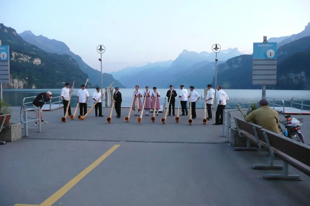
2. Every Wednesday from mid-June to mid-September, Alpine horns are played on the pier and in the city center.
3. From the town you can climb to the top of Urmiberg. This is a great opportunity to see the lake and the surrounding peaks from a height of 702 meters if you don’t have time to climb the Frohnalpstock.
4. From the nearest excursions: Schwyz, Muota Valley, Stoos and Frohnalpstock, Swiss trail, Goldau Zoo, Rigi.
About Schwyz, Muota Valley and Stoos read further.
About Schwiss trail
Goldau zoo and Rigi
5. A little further there are two caves: one at Baar next to Lake Zug, the other in the valley of the Muota River.
Schwyz
How to get
Schwyz can be reached by bus 2 or by train. The rail station is not in the city center. The center can be reached by any bus or on foot.
Schwyz has been known since 972. In 1291, and then in 1315, treaties were concluded that united the cantons into a confederation for a joint struggle against the invaders. These contracts are kept in Schwyz in the Federal Archives (Bundesbriefmuseum).
Interesting are
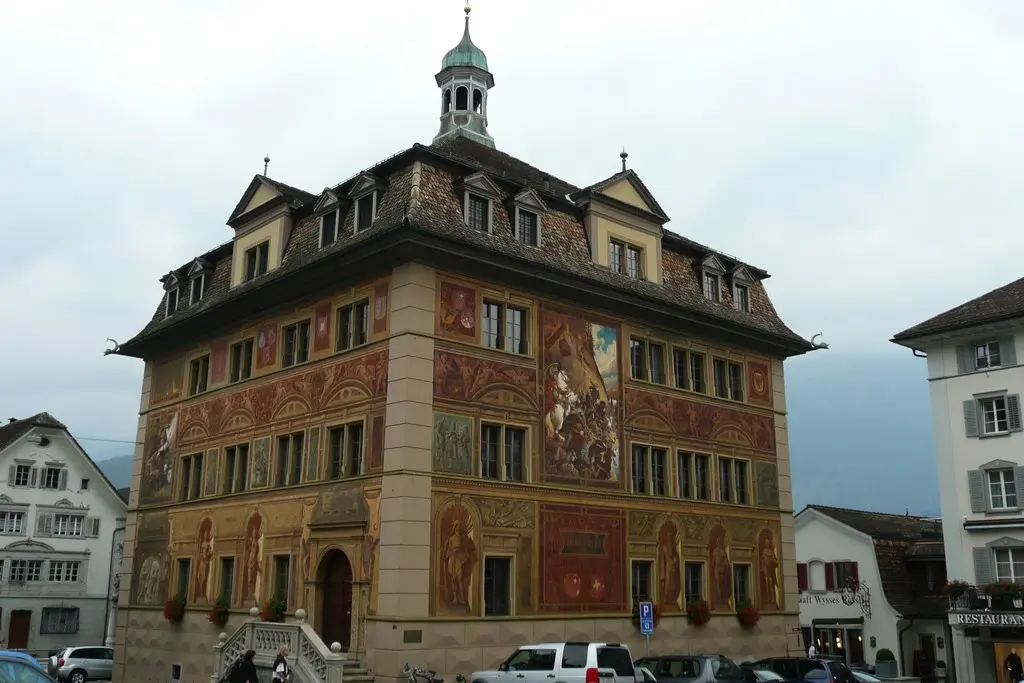
- Town Hall (1779) with a painted facade illustrating the history of the country,
- the oldest house in the canton of Schwyz – Bethlehem (1287, history museum),
- Ital Reding Haus house of 1609 with original interiors of the era (the house belonged to a guardsman who returned from service in Schwyz).
- temporary exhibitions are shown in the Forum of Swiss History building.
In general, despite the status of the main city of the canton, the town is small and you can quickly get around everything. A map with a route to interesting places can be taken from the tourist information office.
Schwyz is also known for producing the famous Victorinox Swiss knives. The brand store is located in the Ibach area. From the city center to the store you need to go down the Schmiеdgasse street (not far from the store there is a bus from Brunnen – stop Mythen Center).
Schwyz stands at the foot of the Mountains Grosser and Kleiner Mythen. You can get closer to them – using the cable car from the village of Sattel (you can get there by rail). There is also a toboggan and a trampoline playground for children (for more details see www.sattel-hochstuckli.ch).
All cable cars and other sights are on the map.
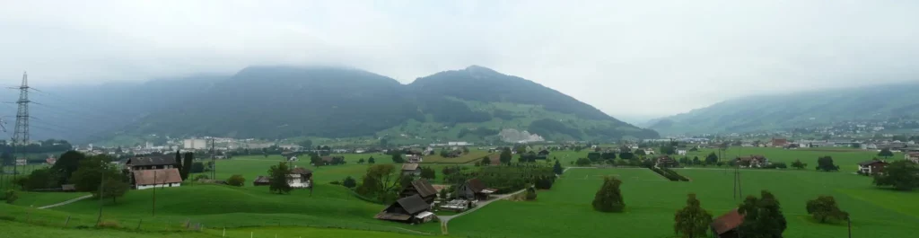
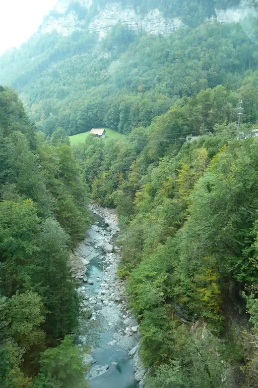
Muota valley (Muotatal)
The weather, which had slowly but steadily worsening for several days, finally worsened completely. Although it hadn’t rained yet, the clouds covered half of the mountains. It was decided to go for a short walk along the Schwyzer tour bicycle route, which we looked at in the information brochure map. We decided to go as far as Schlattli, from where we can climb up using the Stoosbahn funicular.
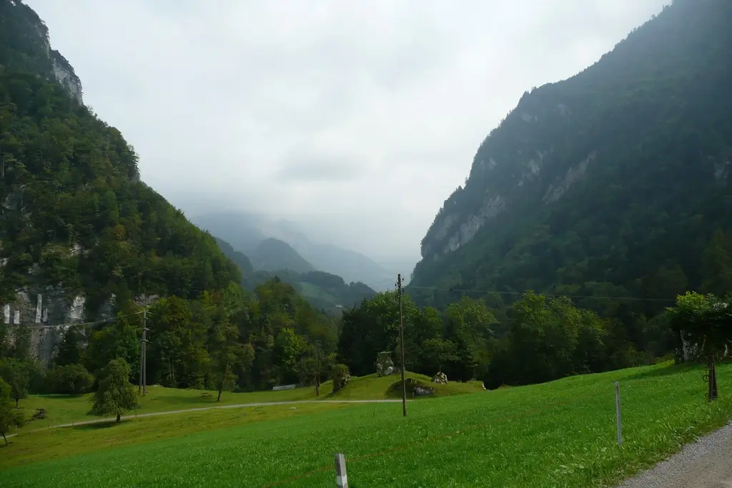
It is a little difficult to get out of Brunnen with help of the map. Since the signs on the terrain, as always, disappear at the right moment. A landmark can be a nunnery on a hill, from it – along the road that goes under the autobahn. Further we had no problems with the road.
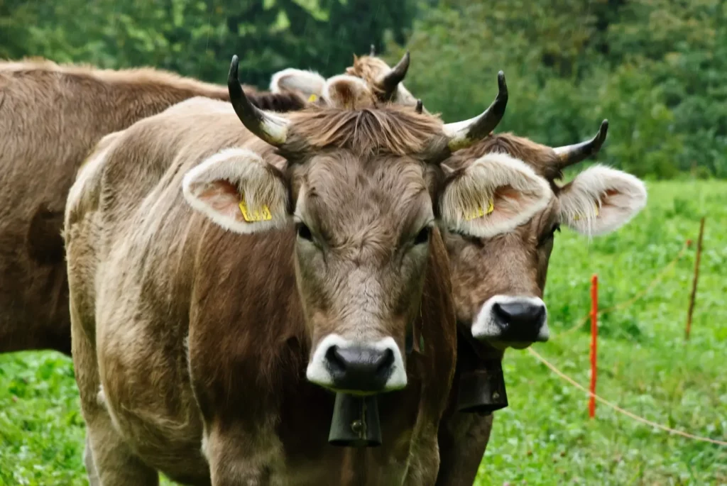
All more or less suitable lawns (and not suitable from the point of view of a normal person) in Switzerland are given to cows. Such madness has not been observed in Austria.
On this day, on the road to Schlattli, the previously pleasant ringing of cow bells (this word is not very suitable for the bucket-like “bells” of local cows) was already arousing hatred. My head was ringing from the incessant clinking, God knows how many animals. It seemed that there were a hundred of them – the sound spread far along the gorge and intensified in the fog.
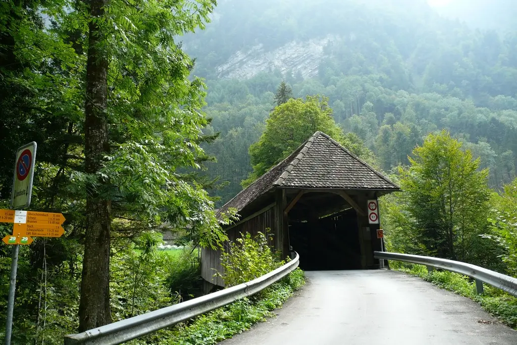
Suvorov bridge
We pass along the forest road along the gorge and unexpectedly find ourselves in front of a barn, through which a car passes. The barn turned out to be a covered bridge over Muota. A sign says that this is the Suvorov Bridge.
We, of course, knew that Suvorov had fought with Napoleon´s troops somewhere in Switzerland. But we did not realize that this “somewhere” is literally here.
The most famous battle of Suvorov’s troops at the Devil’s Bridge near Andermatt. It is easily reachable from Brunnen by train. Having passed the St. Gotthard Pass with battles and overcoming the Devil’s Bridge, Suvorov found that it was impossible to get to Schwyz, where they were going to join other forces, along the lake.
Then Suvorov went through the mountains and ended up in the Muota valley. The position of the troops was almost hopeless: the Austrian allies fled. They could get out of the valley either through a difficult pass, or to Schwyz, occupied by the French. A battle took place in the Muota valley with the French, who were driven back to Schwyz. About one and a half thousand were taken prisoner.
The stone bridge over Muota at an altitude of 50 m was the only one in the gorge. In the battle, the wooden roof was destroyed, the French, fleeing, fell in a crush from a narrow bridge.
Suvorov decided to go through the pass. Thanks to this successful battle, he was able to pass it, fighting only with nature.
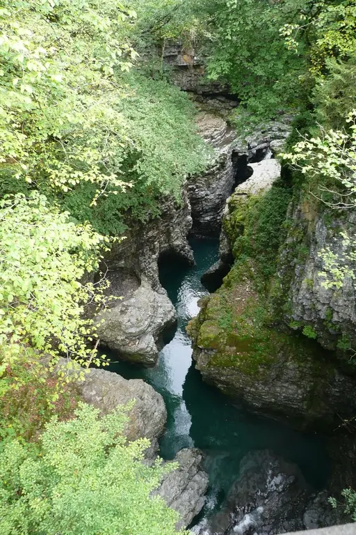
In 1810 the bridge was restored. Through the windows made in the wooden walls, you can see the blue waters of Muota, flowing in a stone bed fanciful cut by a glacier.
Follow me
Funicular Stoosbahn
Close to the bridge is the funicular station to Stoos.
Bus 1 from Schwyz stops at the station. Change from bus 2 from Brunnen should be done at the “Schwyz. Post office” stop. The same bus can be used to get to the village of Muotatal to caves.
Other attractions in the valley include the largest network of caves in Europe, Hölloch (200 km) (end stop of bus 1). The caves are mainly trekking oriented, but it is possible to visit also for ordinary visitors. In an hour and a half you will be shown a small part of 200 km.
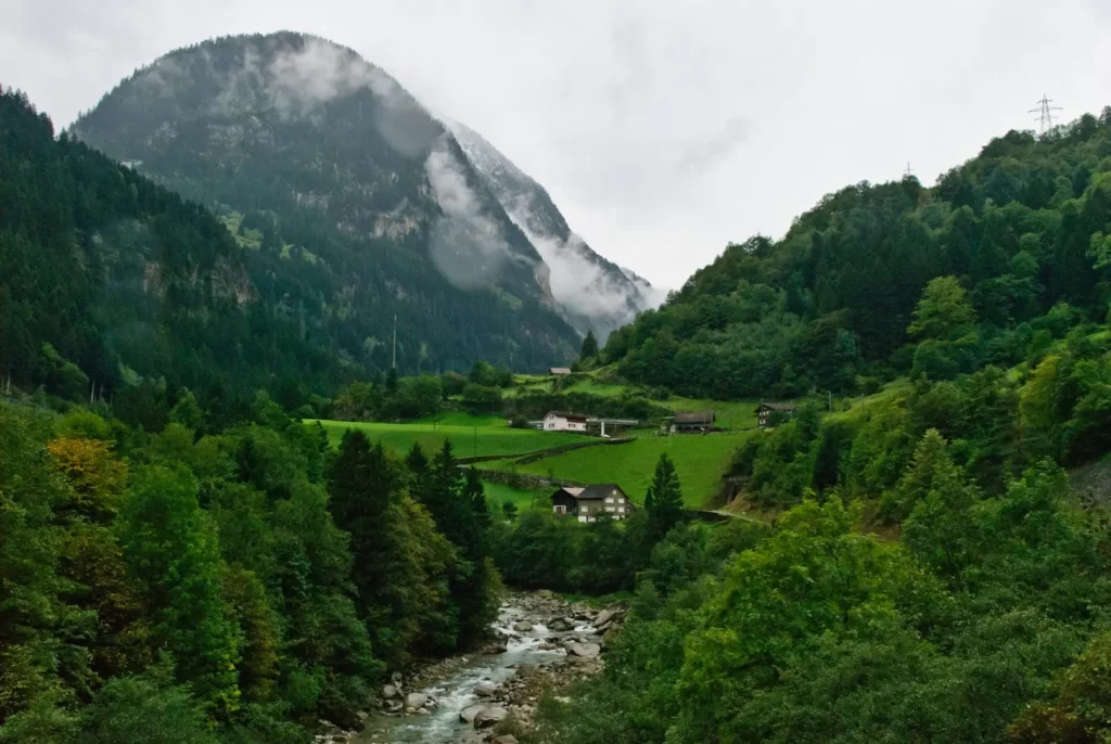
Stoos – Morschach
The funicular went up slowly through the fir trees and steeply up and suddenly almost drove into the cloud.
I always wanted to be on a mountain in a cloud. I don’t want more. It is damp and cold there, the fog (that is, a cloud) penetrates to the bones. But the sensations are unusual. The clouds float below you and through them you can see the valley. Suddenly a cable car emerges from the cloud. On the hill, a ghostly wooden church can be seen.
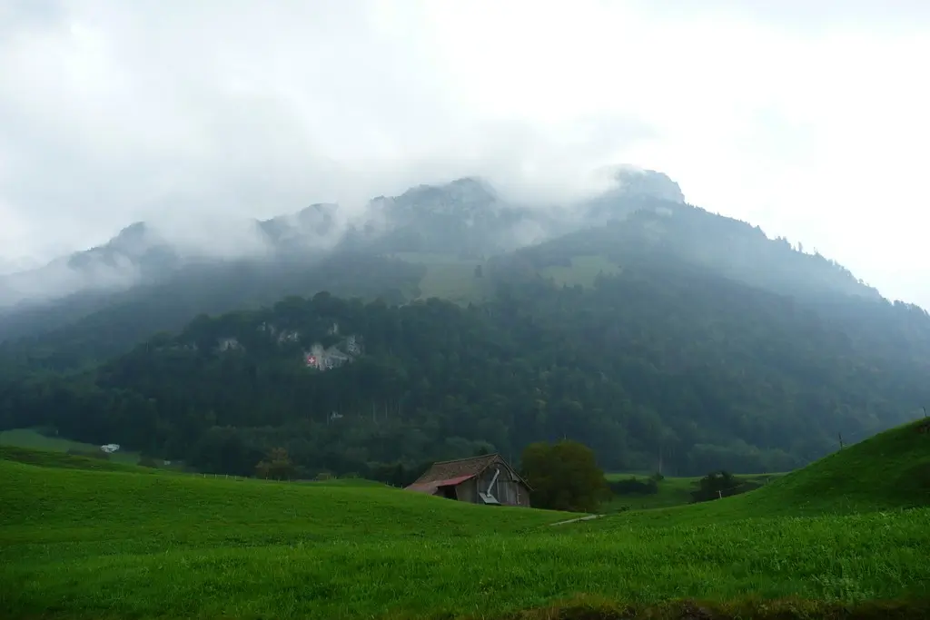
Stoos is a village for mountain walks. There are enough hotels, including 4 stars, apartments are being actively built. We did not go to the top of the Frohnalpstock because of the strong clouds. But the view in the good weather is really stunning.
Morschach
From the cable car station down to Morschach it is not close to go. Better to wait for the bus, which runs quite often.
The main attraction of Morschach is the Swiss Holiday Park and the view of the lake. This not cheap hotel offers a variety of activities, including go-karting, Flying Fox and a thermal pool.
The pool is not amazing but not bad either – average. The temperature is about 30-32, the water in a small jacuzzi pool is warmer – 35 degrees. There is a shallow pool with a toddler slide, a large pipe slide and a warm outdoor pool. To be honest, we froze a little there.
Next we go around beautiful Lake Uri.
about Lucerne
Lake Luzern. Rigi, Tierpark Goldau
Lake Lucerne. 2. Swiss trail. Lake Uri
Lake Lucerne. 3. From Seelisberg to Stans
Lake Lucerne. 4. Pilatus mountain
Jungrau region. 7. Ballenberg
Lake Lucerne. Map of attractions
all posts – #Lake Lucerne
Do you enjoy the site without cookies? This means that I work for you at my own expense.
Perhaps you would like to support my work here.
Or change your cookie settings here. I don’t use personalized ads


