Last Updated on 22/01/2024
Sankt Peter Ording (SPO) is the most developed resort on the shores of the Wadden Sea north of the Elbe. Only the island of Sylt is more known than it. This determines housing prices and a high resort tax, which is also levied on day tourists.
The resort occupies the tip of the Eiderstedt peninsula. In this topic we will explore St. Peter Ording and find out where it makes sense to stay, what you can see in this part of the peninsula, where are which beaches and where to ride a bike.
Part 1. Wadden Sea Schleswig-Holstein: Büsum, Husum, Friedrichstadt
Lübeck old town
Tourist Attractions Schleswig Holstein map
North sea Germany vacation. Things to do
Luneburg Heath. Schneverdingen
Cuxhaven. 1. Center
Cuxhaven Döse and Duhnen
Cuxhaven Sahlenburg
Bremerhaven attractions
The introduction to the topic “Wadden Sea. Schleswig-Holstein” was in the previous part: there you will read about this coast and what you can see in Husum, Büsum and Friedrichstadt.
Eiderstedt peninsula and St. Peter Ording – map, roads, where to stay
The Eiderstedt Peninsula (Halbinsel Eiderstedt) is named after the large river Eider, which forms a bay from the south that juts deep into the mainland. From the north is the protected part of the Wadden Sea with islands and Hallige.
How to get to Sankt Peter Ording
Eiderstedt is a very large piece of land. Take this into account when planning where to live.
Two more or less major roads pass through the peninsula: one leads straight through the center to the SPO the second goes from Tönning along the southern bank to the Eiderstedt dam and further to the SPO.
The rest of the roads are very local, some are quite narrow, so take the navigator’s “shortcut” recommendations with a grain of salt and follow the signs.
There is also a railway running through the center of the peninsula. The train is slow and stops much more frequently than trains this distance usually do. To get on this train you need to change at Husum. On the map, stops are indicated by black rectangles. Some of them are on demand (bei Bedarf, you need to press a button to make the train stop).
Buses are intended for schoolchildren. You can use them, but their schedule is adjusted to the lesson schedule. They don’t go on holidays or weekends.
However, there are two on-call buses ed1 and ed2. You need to call them at least an hour and a half before your trip. Cost at regular rate.
For those who want to have fun in the evening, there is also one night bus to Husum, which runs along the railway.
Bicycles can be rented at many points in SPO, Harding and Tönning (search in Google Fahrradverleih). The prices are great. The terrain is most suitable for bicycles, however the paths outside the city are so-so (already swollen with tree roots and outdated). In most cases, speeds are not necessary, although sometimes you have to drive onto dams. Bicycle roads separated from the route are indicated on the map. You can drive also on local roads, but tourists rush around (it feels like they are trying to drive more than 100 km/h), so I don’t recommend it with children.
Where to stay
Relatively large settlements: St. Peter Ording, Tönning and Garding. Everything else is villages or hamlets.
Despite the fact that Sankt Peter Ording is a large resort on the scale of Schleswig-Holstein, there are not many places to stay. A month before your trip during the season, you are unlikely to find anything in the city itself, and if you do, it will be very expensive. And let’s not forget about the high resort tax (3 euros per adult a day in summer). If other resorts take into account tourist cards of neighboring resorts, then SPO does not do this.
Of course, if you managed to book a appartment at the SPO itself a year before your trip, then the time to the beach will be greatly reduced and you will also have access to a stunning promenade. However, in most cases you still have to walk quite a long way to the sea or take a bus. Therefore, not only the SPO itself, but also the towns along the railway make sense for tourists without a car, and all the rest make sense for tourists with a car (you have to drive to the beach anyway).
Farms also make sense because they can offer additional entertainment or services (for example, free bicycles or breakfast).
But when choosing a non-central location, try to stay close to the red lines on the map – they coincide with regions of more developed infrastructure. In the north and northeast, the roads are so undeveloped that it will take you a long time to get out of there each time – and this takes energy and time for longer trips.
There are large grocery stores in St. Peter Dorf, Harding and Tönning.
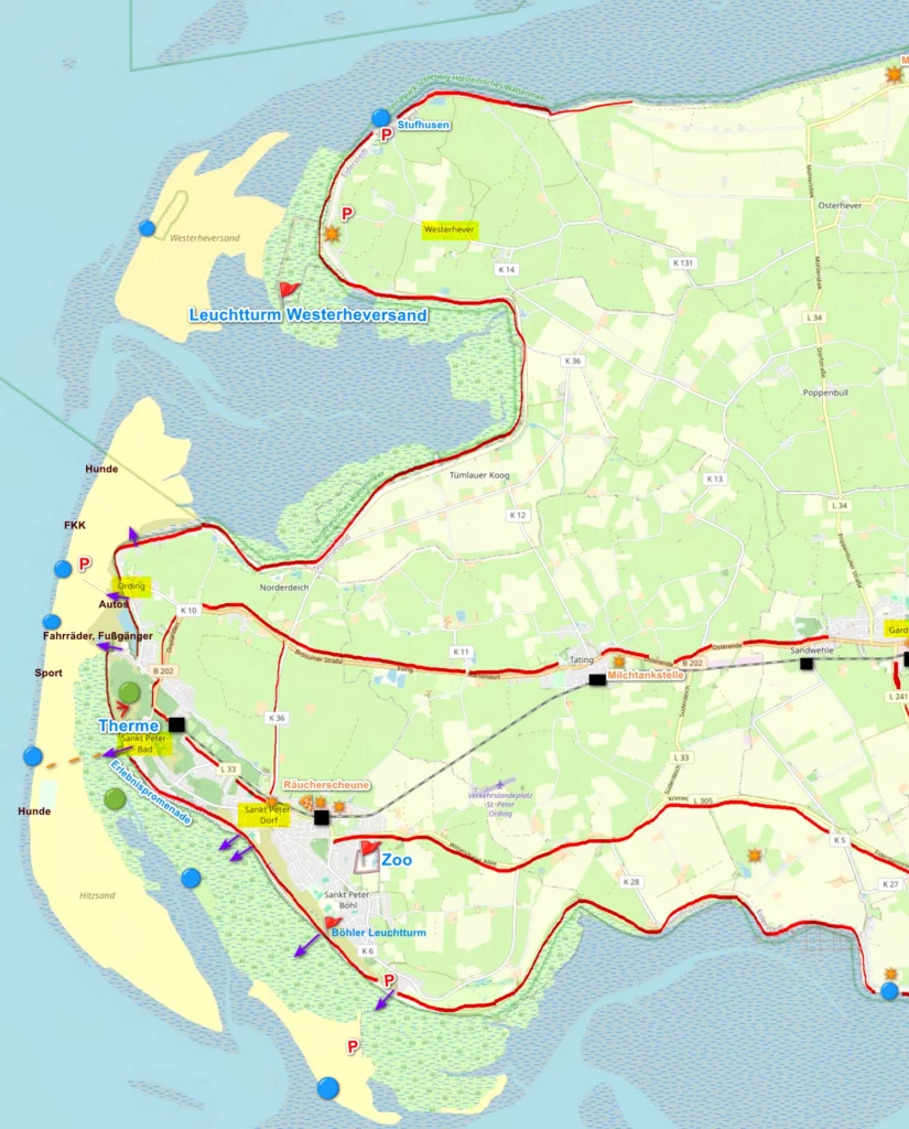
Map of the Eiderstedt Peninsula. St. Peter Ording and Westerhever
This is the western half of the map.
What to look for on the map:
- horizontal blue lines on a gray background are mud flats. However, at the mouth of the Eider River and from the north closer to the mainland it is more likely silt of varying depths than mud flat
- yellow is magnificent sand. Its main drawback is that there is too much of it.
- blue circles indicate beaches. However, there are few real beaches. More on this below. The most important information for the beach is low tide times. You should take the timetable flyer as soon as you arrive and have it with you at all times. This is important for getting back to shore safely if you’re out on the mud flat, and for knowing when there’s a chance to go for a swim.
- green circles are natural areas: in this case, pine forest and dunes, salt meadows
- red flag – the main attractions of the peninsula
- red line – bicycle roads where you can ride with children
- stars – discovered farm shops. Some are also given names. Profiles vary, check online.
- “pizza” – shopping centers (there are also small shops in other places)
Sankt Peter Ording
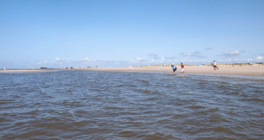
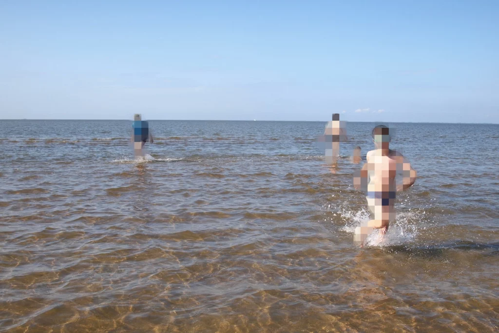
St. Peter Ording is a municipality consisting of St. Peter and Ording. The resort is valued primarily for its endless strip of sand. If you look at the map of the Wadden Sea from the previous topic, you will see that the Wadden Sea on this side of the peninsula is at its minimum width. Therefore, more or less real swimming is possible here. And that means waves too.
Ording
Ording is a small village from the north whose main feature is the parking on the beach.
Parking on the beach is not always open; there is also parking on land, but the walk takes longer. Parking on the beach is similar to parking on dirt or grass during events – the area is lightly marked and everyone is expected to be respectful of other drivers. For parking on the beach you will pay about 12 euros (current prices may vary). Campers and very large vehicles have their own rates. Plus, don’t forget about the resort tax.
North Beach consists of blocks:
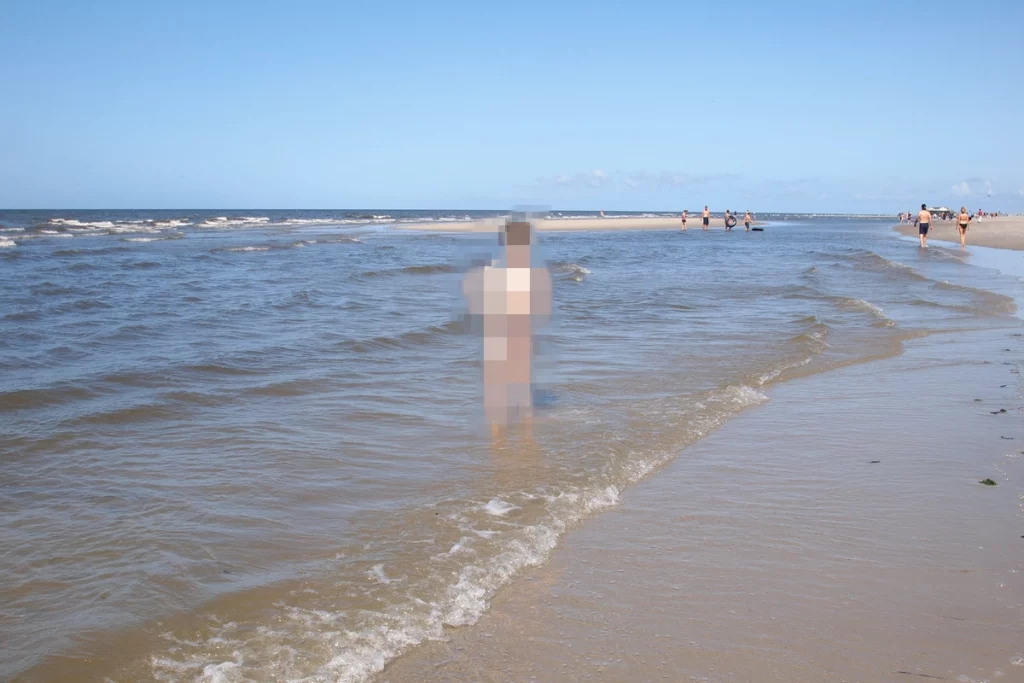
for nudists (right sector from the road to the parking lot),
dog walkers (far right sector, walk 800 meters or use the passage on the northern dam, where there is its own parking – if the water level allows passage there),
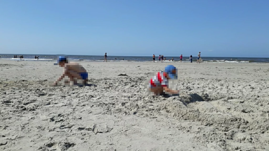
bathing block
and a sports block (left).
Follow the signs
There are not many options for eating here: a snack at the campsite and a couple of cafes, one of which is on the beach.
Between Ording and Sankt Peter Bad there is a large dune surrounded by pine forest. In the center is the Maleens Knoll observation deck. Please note that you cannot smoke in the forest – very old pine trees grow there and the forest is important for protecting the city from sand.
Sankt Peter Bad
In Sankt Peter Bad you will find a thermal pool, a stunning promenade and a family centre. There are plenty of eateries to suit every taste and not expensive.
The longest decking (indicated on the map with a dotted line) leads over salt meadows and channels to the beach.
The length of the decking alone is about a kilometer! Accordingly, we add kilometers and hundreds of meters to any other point in the city. This applies primarily to parking, the railway, housing not in the center and how many things you plan to take.
To help tourists, there are city buses that you can use for free if you have a resort card for that day. Since you still have to pay for a card to get to the beach, it makes sense to use the buses. You can buy a resort card on the bus, it is cheaper than a round trip ticket. However, even without a card the cost of the bus is not very high, not like in Cuxhaven. The bus schedule is available on the city website and in the form of booklets in tourist offices. Line 1 runs from south to north, line 2 vice versa.
Most parking in the city is paid. The prices are very different. There is also the opportunity to park here and there for free along the streets. But you must definitely count the number of kilometers you will have to walk. Access to the beach through the meadow area is only in the places indicated on the map!
On the Sankt Peter Bad beach there is an area for dog walkers (to the left of the boardwalk), a supervised swimming area (right next to the boardwalk), and a sports area for kites (to the right). Look at the signs. There is also a cafe on the beach in wooden buildings on stilts.
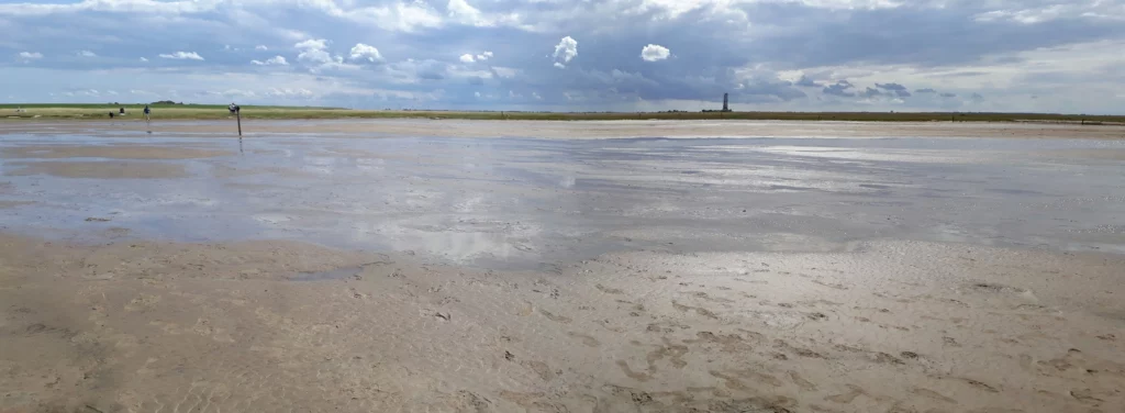
This is about a third of the width of the sand strip.
And the length is endless. The piling structures of the northern beach are visible on the horizon (closer than the parking lot, where pedestrians and cyclists can enter)
The promenade (Erlebnis Promenade) consists of
– path along the dam with various information stands,
– numerous children’s and small sports grounds of various types below the dam,
– promenade protected by trees and bushes below the dam.
This one and a half kilometer stretch of pure pleasure ends with a new family center with a huge slide.
On the other side of the dam, between the dam and the sand strip, there are salty meadows. You can go down there if the condition of the paths allows. Even at the end of August, wild rose thickets bloom there.
We did not try the thermal pool in St. Peter Ording because of the price. In addition to the “net price” for the pool, there is also a surcharge for “heating”, plus the resort tax and plus the cost of parking. Look carefully at the small print. Since we planned the pool on the Baltic side of Schleswig-Holstein, it was decided to skip this one.
Sankt Peter Dorf, Sankt Peter Böhl
Dorf is the old part of the municipality. In addition to old houses, there is an tourist information center, a museum of the region (Museum Landschaft Eiderstedt) and the amber museum (Bernsteinmuseum).
From the center you can access Südstrand beach. If you look at the map you will see that there are too little there at low tide. During the season, a bus goes to the beach.
The farthest beach of St. Peter Ording is called Böhler Strand. There is a parking “on land” and a beach parking too. Alternatively, you can go there by bus.
Considering how much parking on land costs and how far it is to walk from it, the choice should be made in favor of parking on the beach or taking a bus.
The only food options here are a cafe on the beach and a cafe near the parking lots on land.
Other attractions in the southern part of Sankt Peter Ording include the zoo and the Böhler Leuchtturm lighthouse.
The Westküstenpark und Robbarium zoo contains seals, birds and ungulates. The main focus is, of course, on seals. Since there are many ponds on the territory, there are also many aquatic and semi-aquatic birds. But for variety, a terrarium, rhea, alpacas, an aquarium, mongooses, and small animals were added. Pay attention to combined tickets (with a boat excursion to the seal rookeries or with Multimar) and feeding times.
The zoo is located relatively close to the train stop (a kilometer on foot) and 3 kilometers from the beach. The city bus also stops here.
Opposite the train stop is a large shopping center, which also has a farm store and a fish smokehouse.
Westerhever
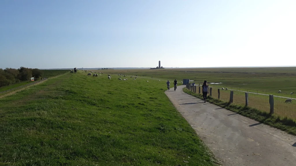
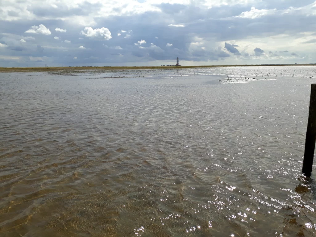
Westerhever is visited primarily for its lighthouse (1906, 40 meters, can be visited with a guided tour).
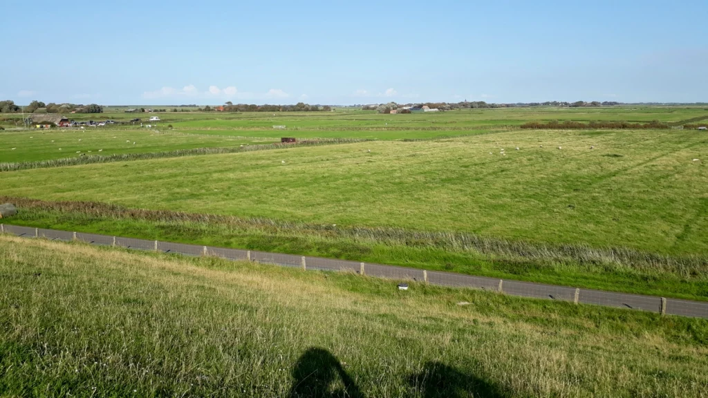
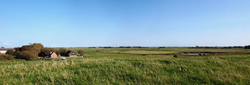
The settlement itself can hardly be called a village – it is a group of farmsteads scattered between countless canals and dams, every meter between which is given over to fields and pastures. Between all this there are narrow roads, most of which are not suitable for cars traffic.
This is the typical landscape of the northern part of the peninsula. It is more prone to flooding than the southern one.
There are two parking lots in Westerhever. One of them is the main one – for trips to the lighthouse and to the sandy beach. The second is small and (for now, at least) free – for walking and swimming on the mud flat.
Let’s start from the Westerhever Leuchtturm parking lot.
So you parked and climbed the dam. Look at this carefully and think: do you really want to take all these things? Are you sure you don’t want to wear a jacket? did you forget your baby’s stroller? and especially: do you need to visit anything while parking is nearby?
The “beach” in Westerhever is kilometers of flooded meadows, mud flat and sand without infrastructure. The entire infrastructure in the form of a washing tap, a cafe and a toilet remains behind the dam, below the parking lot.
Follow me
If you are going to the beach, and not to the lighthouse, then after the first “green” kilometer another couple of kilometers will begin, first of mud flat, then of sand. Things are usually left at the end of the green stripe. I recommend staying here for those with small children.
And here by the way about the weather. We started in the previous photo with clear skies and wind. We ended with storm clouds. Study carefully the forecast and believe the worst case scenario.
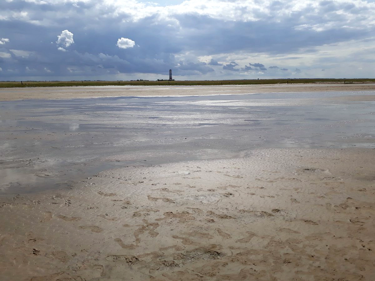
The photo shows the beginning of the mud flat and the end of the meadow, looking back towards the parking lot.
And this is how far you will have to go further to the sand and sea. Are you sure you need to go there?
If you are looking for a place where you can feel completely alone, try walking along the Westerhever mud flat. Even the mud flat here is lifeless, rather just trampled ground. I love mud flat, but this one made me panic. Probably, people who find themselves in the desert for the first time have a similar feeling.

View towards Sankt Peter Ording
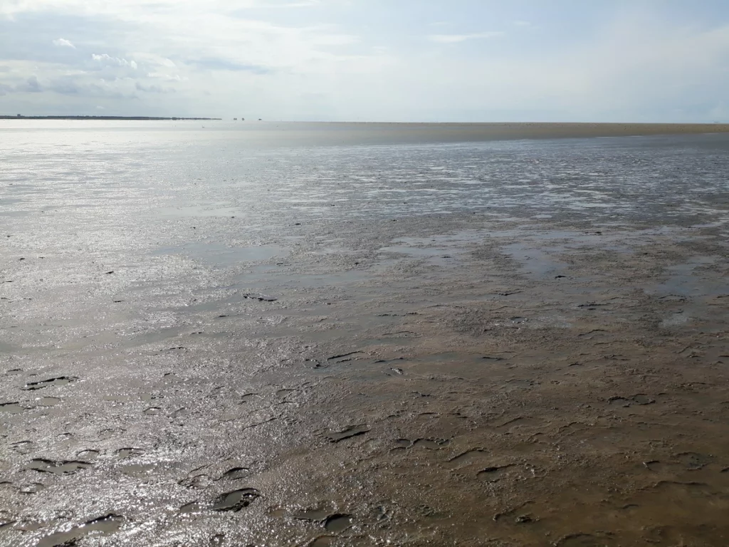
Attention: Mud flat is flooded! Quite shallow, but nevertheless you can be cut off from the mainland if you linger on a sand bank.
After a specific walk through the mud flat desert, we go to the “paddling pool” – to a small beach near the Stufhusen parking lot.
In fact, it’s hard to call it a beach. There is a bicycle road at the foot of the high dam. There is also a faucet to wash off the salt and mud if you get it. Stone slabs or stairs lead down to the mud flat. At the very edge of the descent there is a small strip of hard ground and in places a little dry sand. The rest of the space is occupied by a mud flat with many shells and small stones, or a swampy land through which you need to go to get to the water. I don’t recommend stepping into the channels in this swampy land – it’s a snag, full of silt, deeper than you think. You can jump from one solid area to another. But it’s better to go by mud flat, although it takes longer.

What’s good about this? This is a great mud flat for “swimming” with small kids. Very shallow, clean and the water warms up.
This concludes our journey along the western tip of the Eiderstedt Peninsula. In the next part we visit Tönning, drive along the southern coast of the peninsula and see if there is anything else interesting here.
Part 1. Wadden Sea Schleswig-Holstein: Büsum, Husum, Friedrichstadt
Lübeck old town
Tourist Attractions Schleswig Holstein map
North sea Germany vacation. Things to do
Luneburg Heath. Schneverdingen
Cuxhaven. 1. Center
Cuxhaven Döse and Duhnen
Cuxhaven Sahlenburg
Bremerhaven attractions
Do you enjoy the site without cookies? This means that I work for you at my own expense.
Perhaps you would like to support my work here.
Or change your cookie settings here. I don’t use personalized ads
