Last Updated on 30/11/2023
The Rhine gorges, or rather gorges of its sources Vorderrhein and Hinterrhein (“Anterior” and “Posterior” Rhine), are a must-see program. You can see the Viamala Gorge in an hour (or a day if you’d like to hike) and the Ruinaulta Gorge in at least one day (preferably two – from above and below).
In this topic, a map of the region with attractions and a detailed description of the gorges. The region is located in the canton of Graubünden.
Rhine Delta Bodensee, Appenzell attractions
Around Walensee
Ticino attractions map. Locarno, Bellinzona and valleys
Lake Lugano attractions map
Swiss side of Lake Constance
Rhine Falls
Lake Lucerne map of attractions
Jungfrau region Map
From Lake Constance to Chur, the Rhine is, in fact, a utilitarian natural unit: it is densely populated, regulated and built up with industrial facilities. Just above the Chur, the Rhine, as a river, actually begins: here the Hinterrhein and the Vorderrhein merge. And here there is no industry, only tourism, and very developed tourism.
In Graubünden, German and Romansh are spoken. The second is gradually losing its positions more and more, but its presence is strongly felt in the dialect and inscriptions.
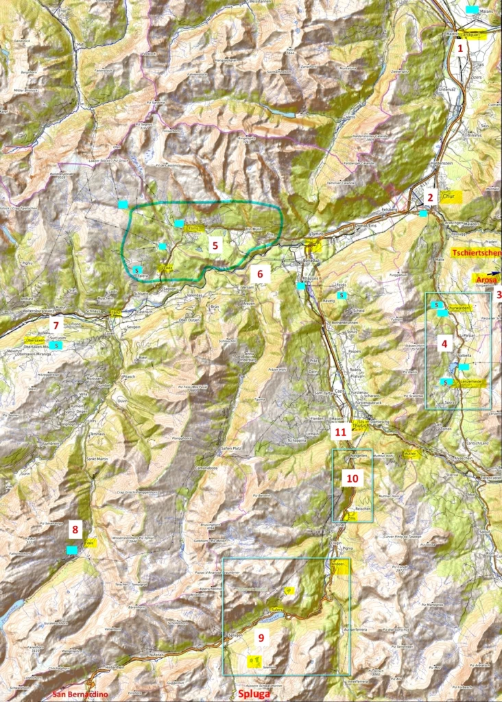
Everything important that you can see in the region – with notes and links.
- 1 – top
- 2 – very good, although not so well known
- 3 – good for a short vacation or a layover. Several medium-level interesting places
- 4 – local or specific, not for everyone
Marks without brackets – I was there (there are links to the posts). With brackets – I wasn’t there. Of course, the notes are subjective
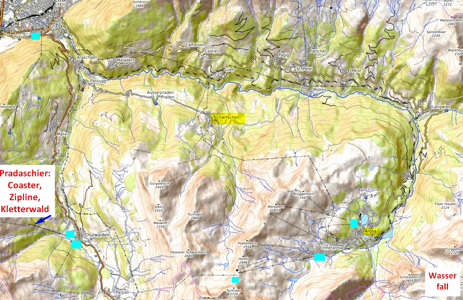
Around Chur
(4)
1. Landquart
The only exception is in the industrial use of the river. Due to poverty, local residents were unable to build structures regulating the Rhine. As a result, Mastrilser Rheinauen, the floodplain around the Rhine, is a unique place where rare plants grow and rare amphibians and birds live.
There is also an outlet village here.
(3)
2. Chur
Chur can boast a very good preserved old town. In addition to streets and squares, there are also a number of churches, the most interesting of which are the cathedral (12-13th century, Gothic altar), the church of St. Martin (15th-16th centuries).
Urban-golf (golf with a soft ball on the streets of the city, equipment and instructions in the tourist info)
Museums:
natural history Link
museum of the region
musem of art Link
Forum Würth (one of the museum complexes of the Swabian entrepreneur, philanthropist and collector Würth, in this case with a focus on sculpture) Link
cathedral treasures Link
Roman excavations
winemaking museum Torculum Link
Cableway to the “home” mountain Brambrüesch Link
Nearby:
Schloss Reichenau – the confluence of the two sources of the Rhine, the winery in the palace Reichenau.
Tschiertschen – picturesque village
Public transport: bus 42 from Chur
(2)
3. Arosa
Popular family mountain resort Arosa with several lakes, a waterfall, cable cars.
There is also a rope park, an alpine garden, an indoor skating rink, and a cheese factory. At the intermediate station of the cable car there is a bear park. A path where you can feed the squirrels.
To Arosa, a railway rises with an impressive viaduct.
If you plan to spend an active day in Arosa, pay attention to the all-inclusive ticket – Arosa Card (for those who stay in Arosa – free of charge, for guests for the day – 50 euros)

(3-4)
4. Lenzerheide
Resort valley with several cable cars, on the other side of the ridge from Arosa.
Rope park, Zipline, Coaster.
cheese dairy.
Thermal pool H2Lai
Church Klosterkirche in Churwalden (1500, murals, altar)
Public transport: bus 182 from Chur
Vorderrhein – Ruinaulta gorge
1
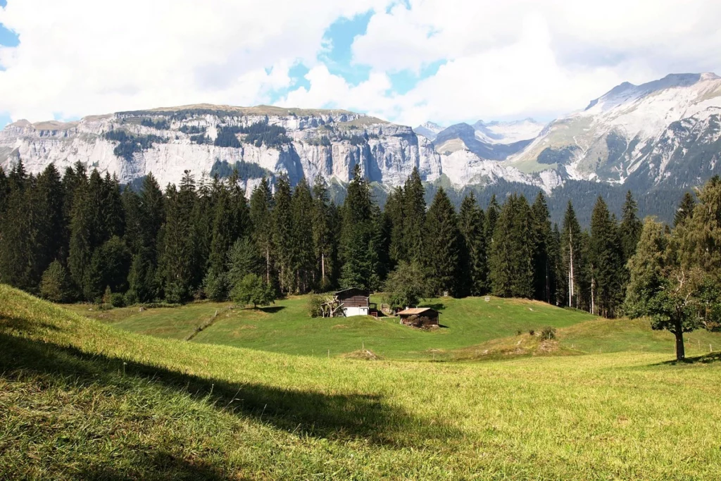
5. Resort Flims – Laax
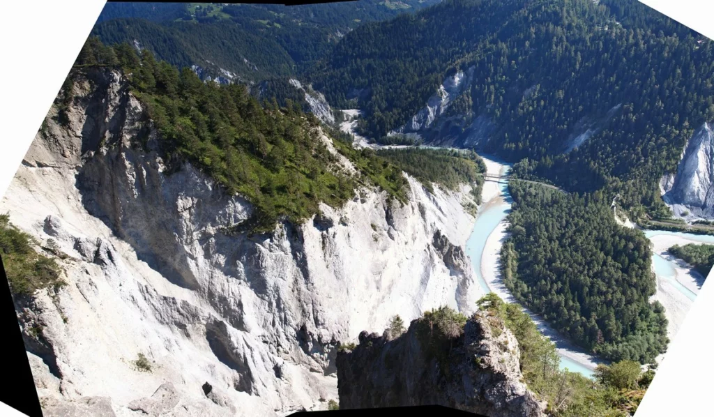
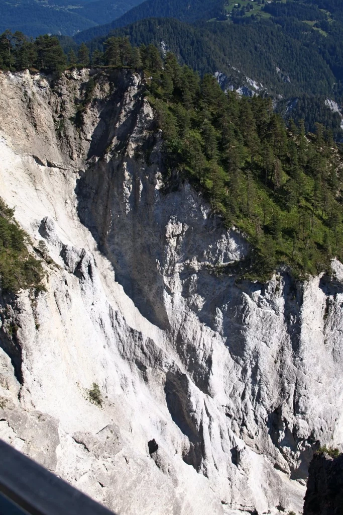
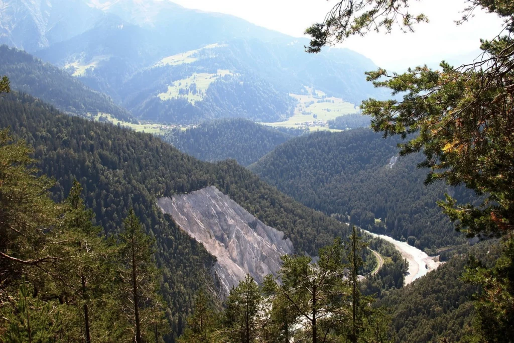
Ruinaulta Gorge and the upland where Flims is located were formed as a result of the collapse of part of the mountain approximately 9500 years ago. This is the largest known collapse in the world (if you have seen Goldau, you can compare: this collapse is 300 times larger). The resulting folded hills were not interesting for agriculture, so they preserved wonderful coniferous forests. It’s just a pleasure to hike there. The forest gave its name to this part of the Anterior Rhine – Surselva (“on the forest”)
The main road Oberalpstrasse to Flims runs at a significant height near the mountains on the right side from Chur (500 meters relatively gentle ascent). After Flims, the road gradually descends again (but the gorge also ends). You can also drive through the gorge with the regular bus or with the open cabrio bus.
Public transport: bus 81 Chur – Flims – Laax – Falera
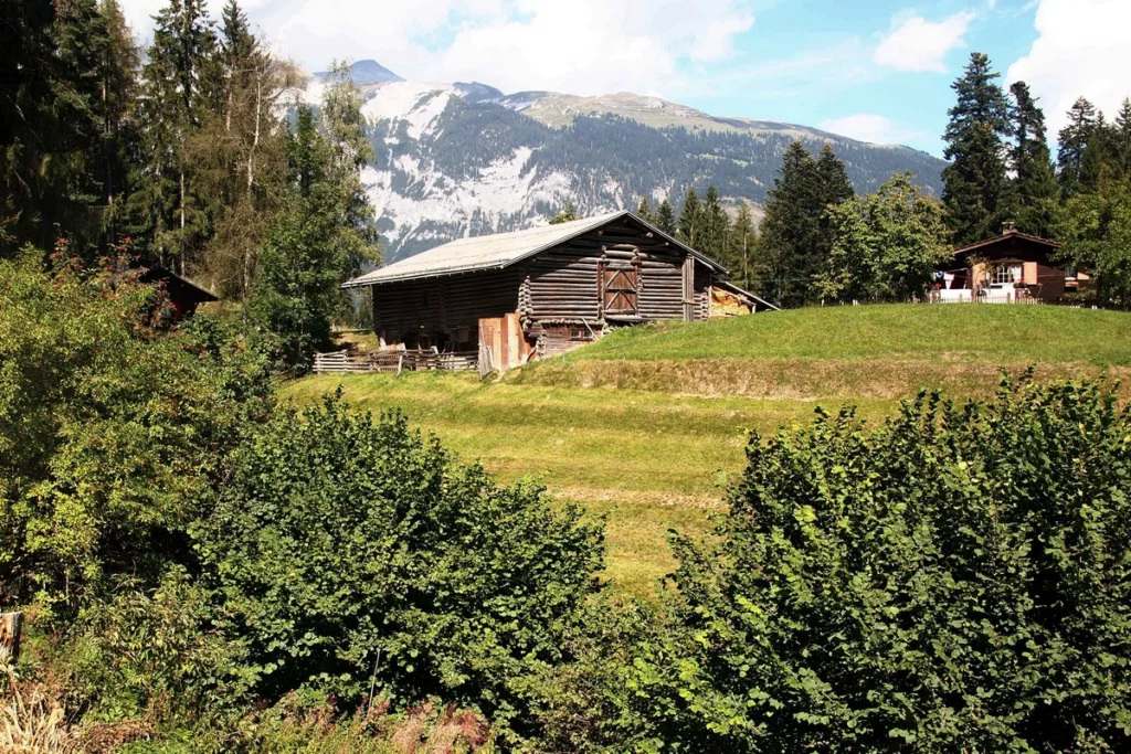
Flims
Flims is a very developed resort, with multi-storey hotels, large shops. For example, Grindelwald, which is much more famous, was far from being so developed and looked more like a village. The resort consists of two parts: Flims Dorf and Flims Waldhaus. The second one is lower, on the edge of the forest, and closer to the gorge, the first one is higher, closer to the mountains and the cable car.
Attractions (the map will be futher):
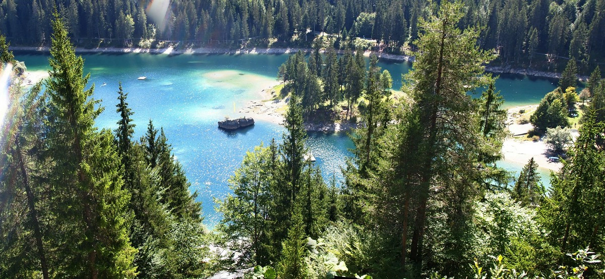
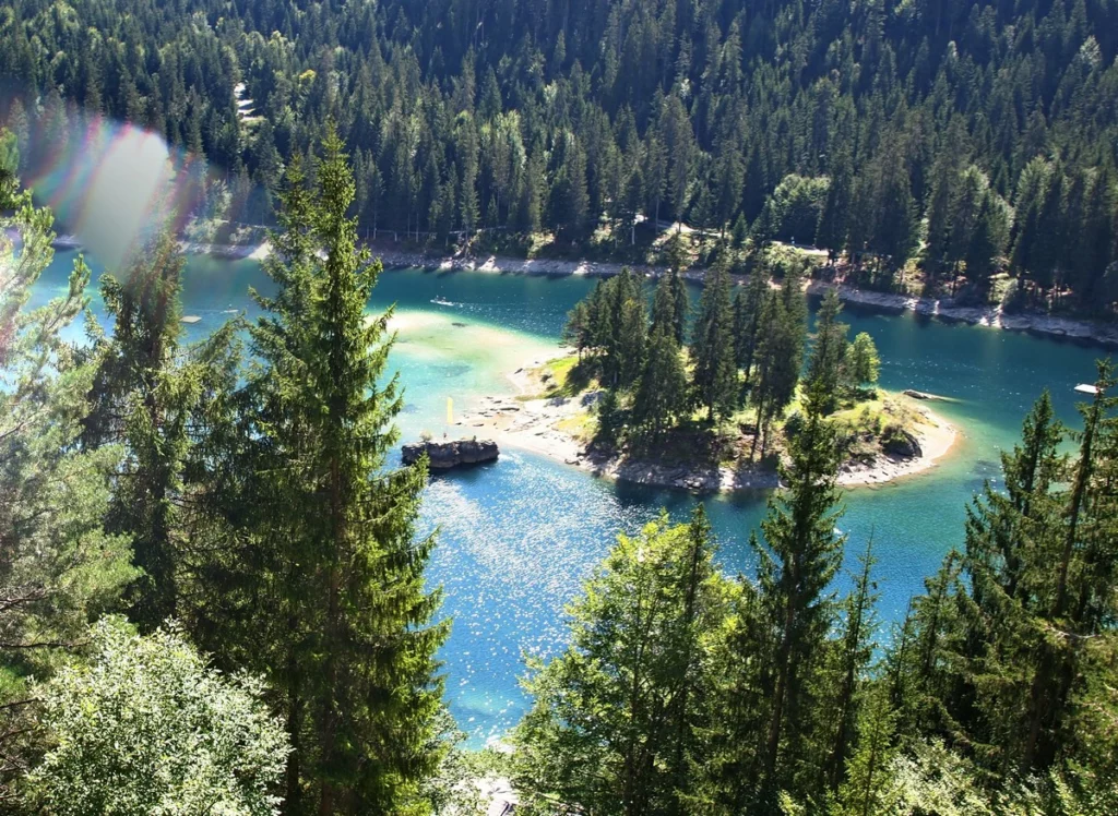
green-blue Caumasee lake with islets and white sand
the path to Conn, where the best observation deck on the Ruinault Gorge (photos further)
stream Connbächli
Cable car: hiking. Link Flims is the southernmost part of Sardona, a mountain range included in the UNESCO list. In 2024, a new cable car will open, which will combine the two existing
Martinsloch stone window: March 12, 13, September 30 and October 1, the sun shines through the window directly on the church in the village of Elm. There is a waterfall
jump center (including for kids) Link
rope park Link
Laax
lake
treetop path 1.5 km long Senda dil Dragun Link
cable car Link
Trin
very beautiful lake Crestasee, where you can swim (extra charge)
historic via ferrata Klettersteig Pinut
glacier garden: a chain of small lakes in the form of baths Strudeltöpfe Alp Mora.
Falera
chair lift Link
the largest group of megaliths in Switzerland (1600-1200 BC) Parc La Mutta Falera
observatory Link
Church St. Remigius
Blue rectangles – cable cars, with the letter “s” – chairlifts, green – viewing platforms. The blue line is a stream Connbächli.
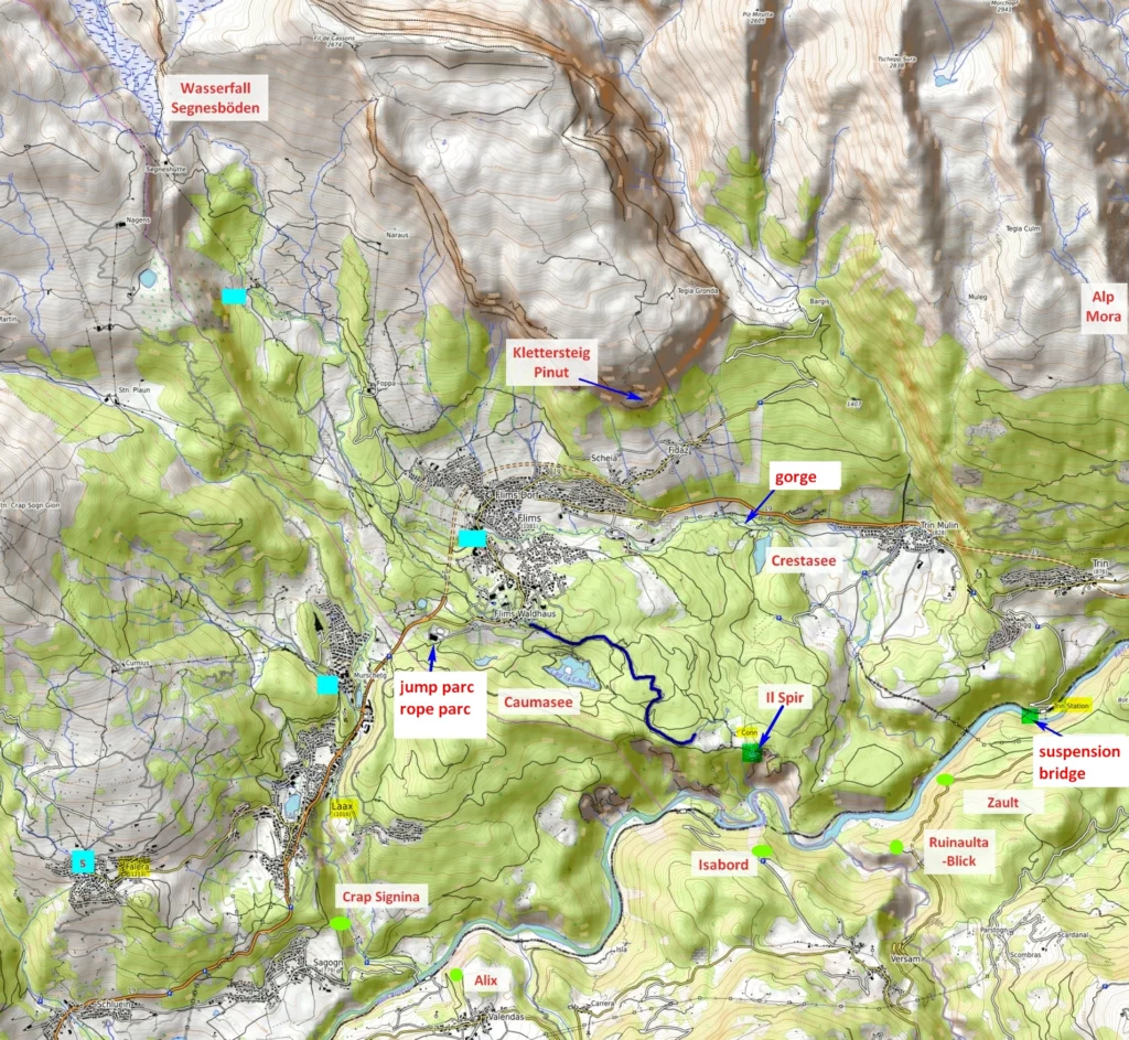
Walk to the Ruinaulta Gorge to Il Spir observation point
From the car park at Flims Waldhaus. For payment, stock up on francs-coins. When planning your hike, keep in mind that the view from Il Spir is lit up by the sun in the middle of the day.

Passable, trampled forest road without large stones

good passable
Length – round trip about 6 km (depending on which path to choose)
Pleasure – 5*
Education – 0
Age – any, the problem may be in the distance. For those who are tired there is a horse-drawn carriage (running according to the schedule, it is advisable to reserve)
Immediately after the start, you can choose the road that goes down to Caumasee. Or go down to it using the funicular (for a fee), which appears after 10 minutes on foot along the main path. Rest on the lake is paid.
But we’re moving on. The road is wide and good.
On the way there will be an artificial stream Connbächli. You can walk to the cliffs along this stream, or choose another path. The 6 km long stream used to be used to bring water to the animals in the village of Conn. The water in the stream is icy and very fast. You can’t walk along the stream with a stroller,.
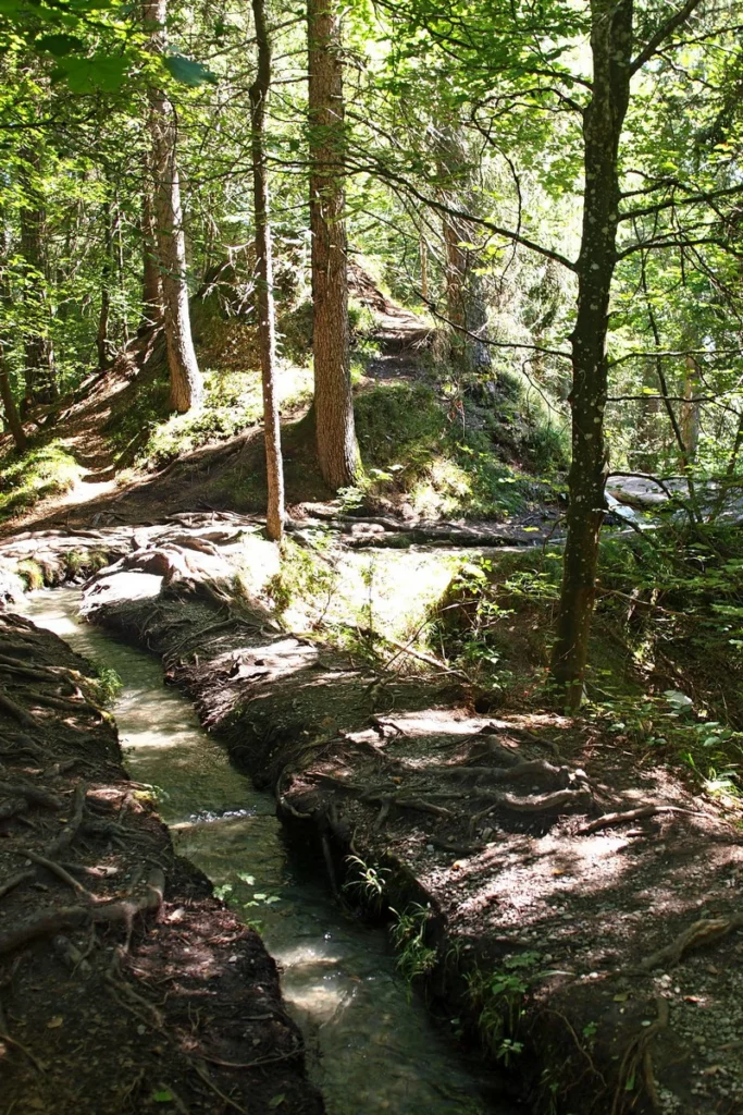

You need to go all the time along the widest road straight ahead. At two crossroads, choose the road straight ahead.
Toward the end, a village will appear and after it we go to a cliff.

Sardona mountains.
The cliffs are almost not fenced – they believe in your consciousness. Everything is just as you thought – free flight right behind the stone. There are several such benches.
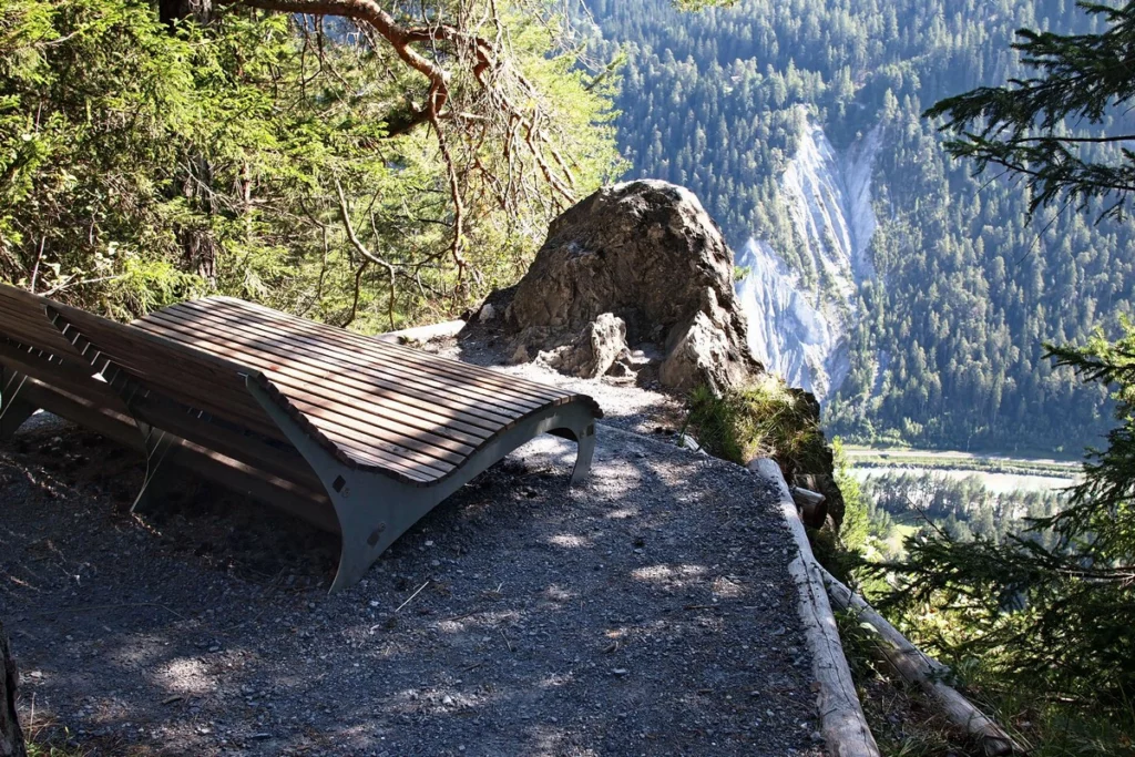
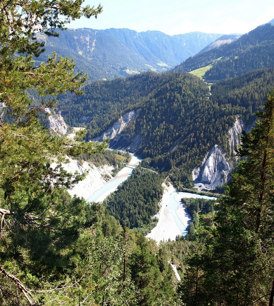
At the cliff, turn left to get to Il Spir. Unfortunately, we were in the peak sun, so the photos are blown out. In addition, the eyes really see more.

After the observation deck, you can turn right along the cliff (upstream) and go back to the Caumasee lake further clockwise.
1
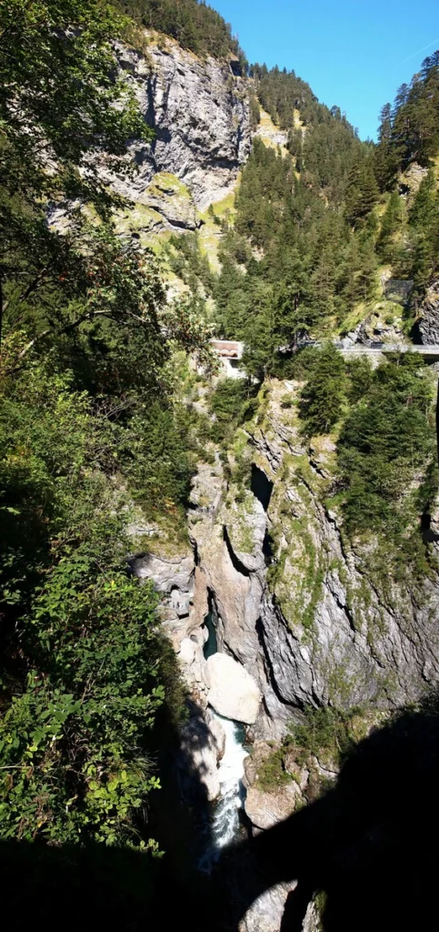
6. Ruinaulta – by train through the gorge
Not every gorge provides such an opportunity – to pass through it by train. By car on the left bank (from Chur) is also possible, but difficult. There are several viewing platforms, you can see them on the map above:
Wackenau
Zault
Rhuinaulta-Blick (Spitg)
Isabord
Alix
The most interesting seems to be Isabord, which is located opposite Il Spir on the opposite bank.
At the bottom, the most interesting is the section around the Versam train station, this is again the area that can be seen from Il Spir and Isabord.
Trin station has a suspension bridge.
(4)
7. Ilanz
Ilanz – old town. Here the gorge has already ended, the banks diverge into a wider valley.
Obersaxen – amusement park Rufalipark
(4)
8. Vals
Thermal pool
Cable car (free) Link
reservoir
Rotabärg gorge on the way to reservoir
Hinterrhein – Viamala gorge
(3)
9. Sufers, Andeers
Sufers
lake
Crestawald – cold war fortress Link
Andeers
Thermal pool Mineralbad
Rofflaschlucht gorge with a waterfall – halfway between Sufers and Andeers. Link
1
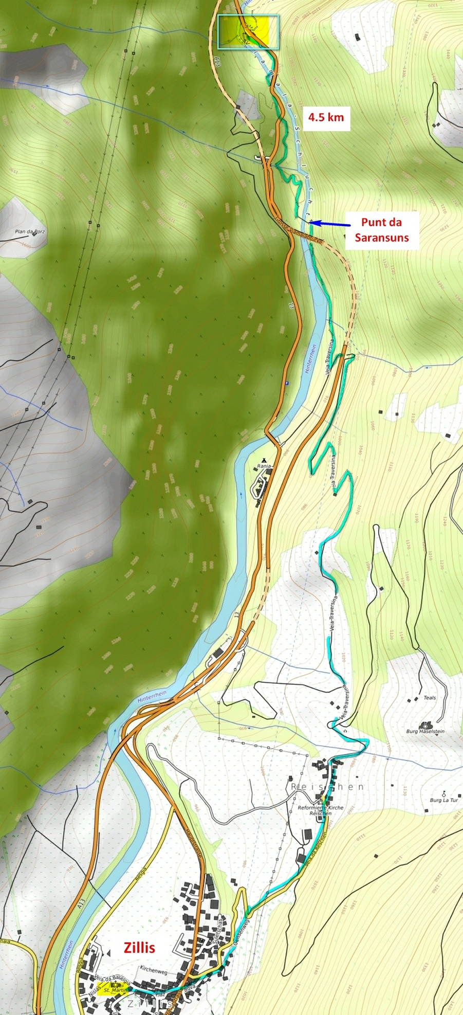
10. Viamala gorge, Zillis
Viamala is Latin for “bad road”. It’s amazing how the Romans even managed to get through here.
Viamala is called the section from Zillis to Thusis. Approximately in the middle of this segment, the gorge narrows as much as possible, its walls rise to 300 meters. In this place, a new visitor center has recently been built and the staircases have been renovated. Link The parking lot is not very big, but the places are quickly vacated. If there are no spaces, take the road back north, there are a few more parking spaces.
The visit will not take long (approximately an hour) – you can see a not so big section of the gorge. However, there are many steps.
With children – only in the arms or with those who can climb themselves. The entire path is well fenced.
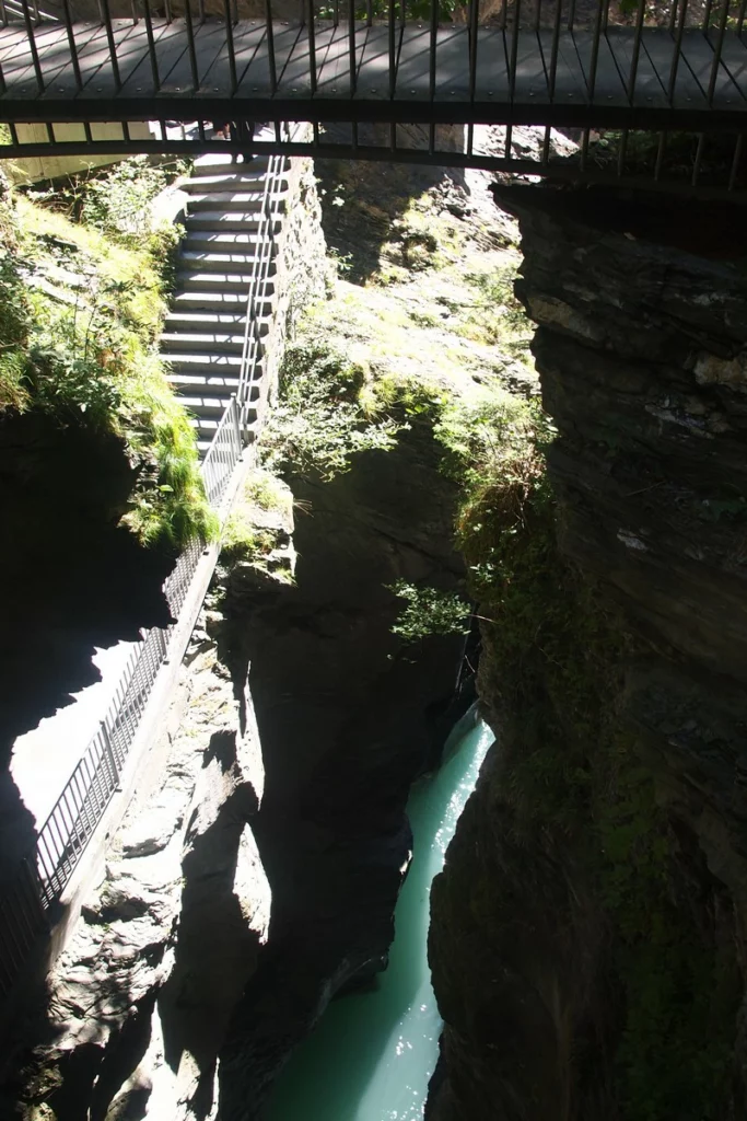
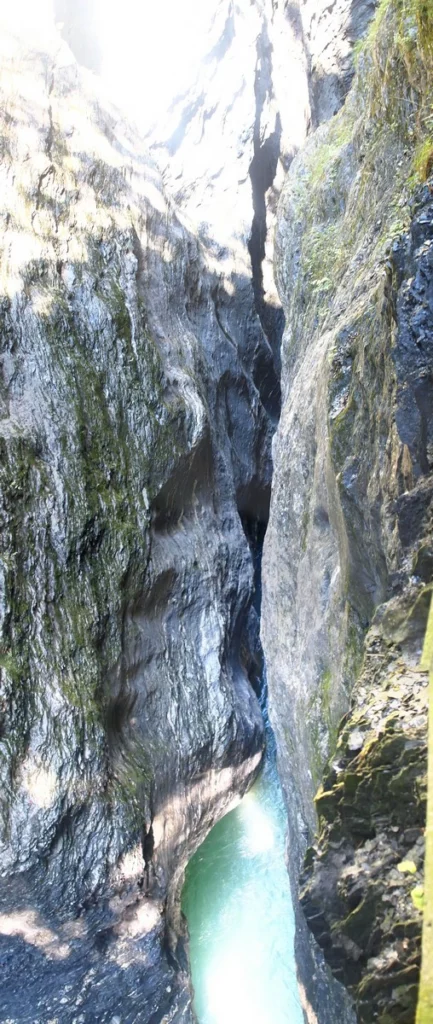
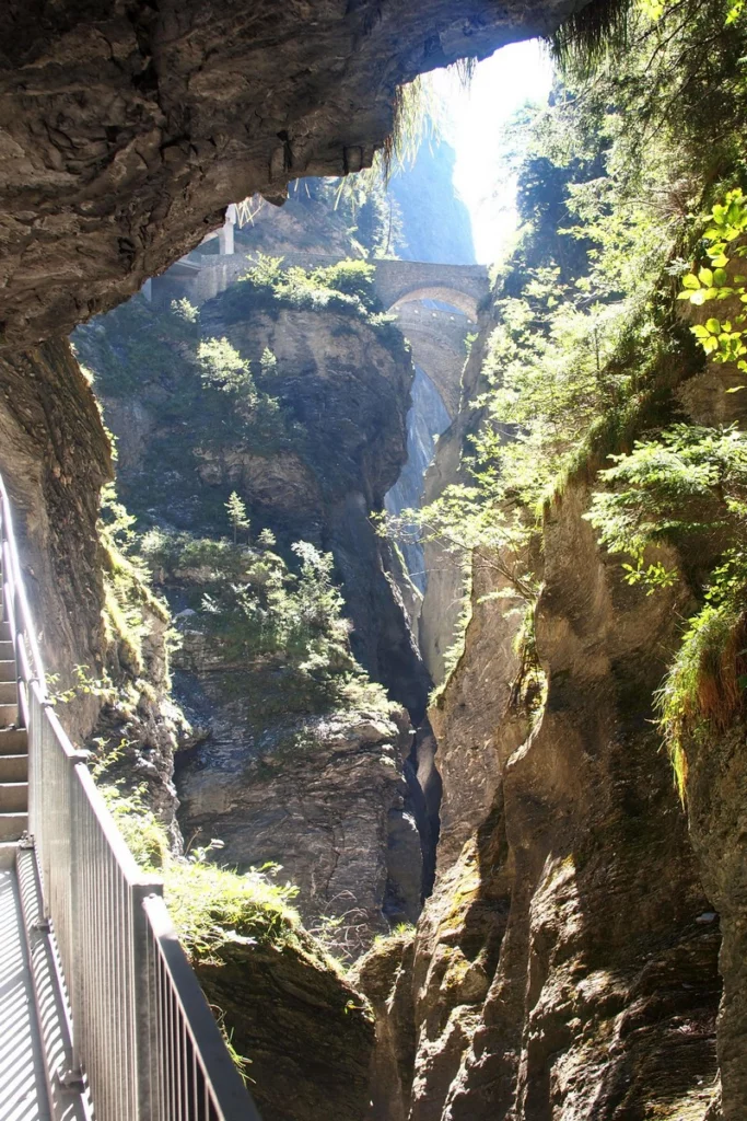
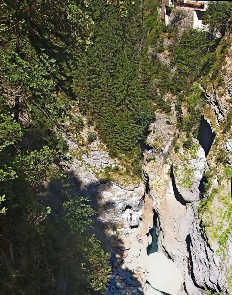
Now let’s see the Rhine gorge, and then we will study what routes the gorge offers. There will be a lot of vertical long photos, because individual photos are illegible something, and only in long panoramas you can see what it was.
So, you pay at the checkout and go down the first series of stairs to about the middle.
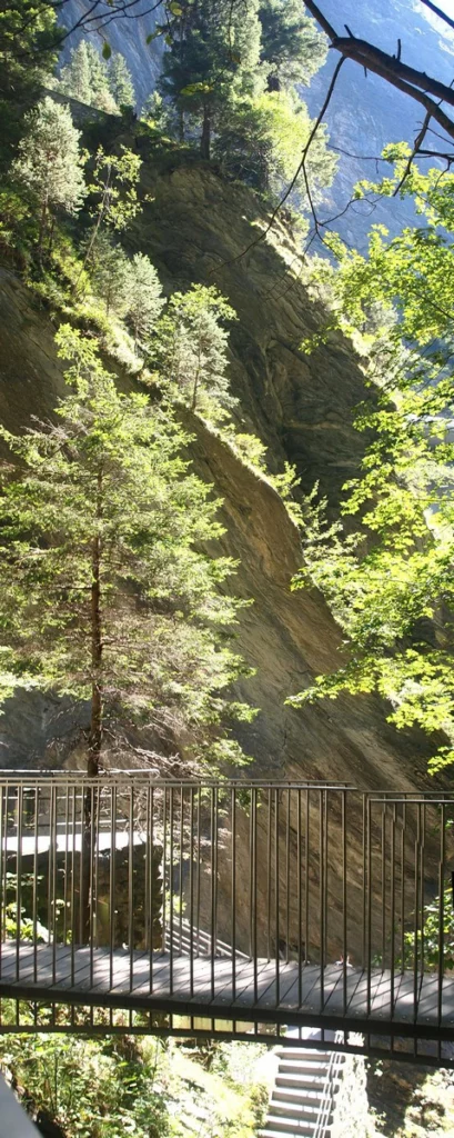
Then we’ll look from the platform on the right (second) photo.
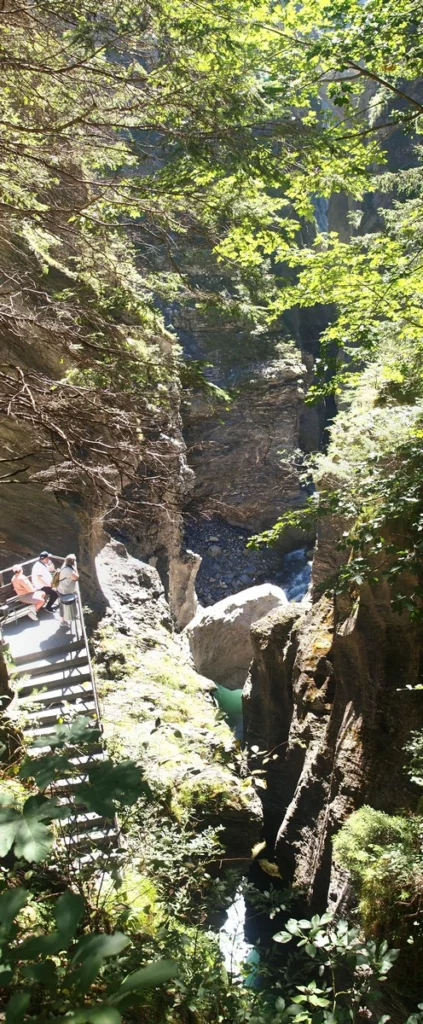
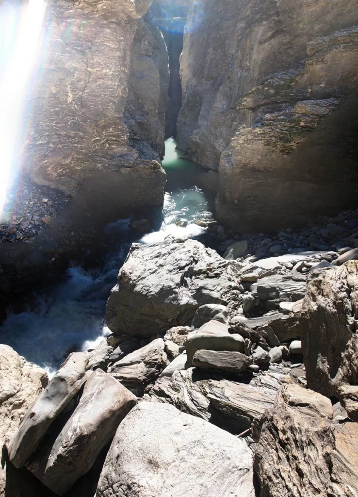
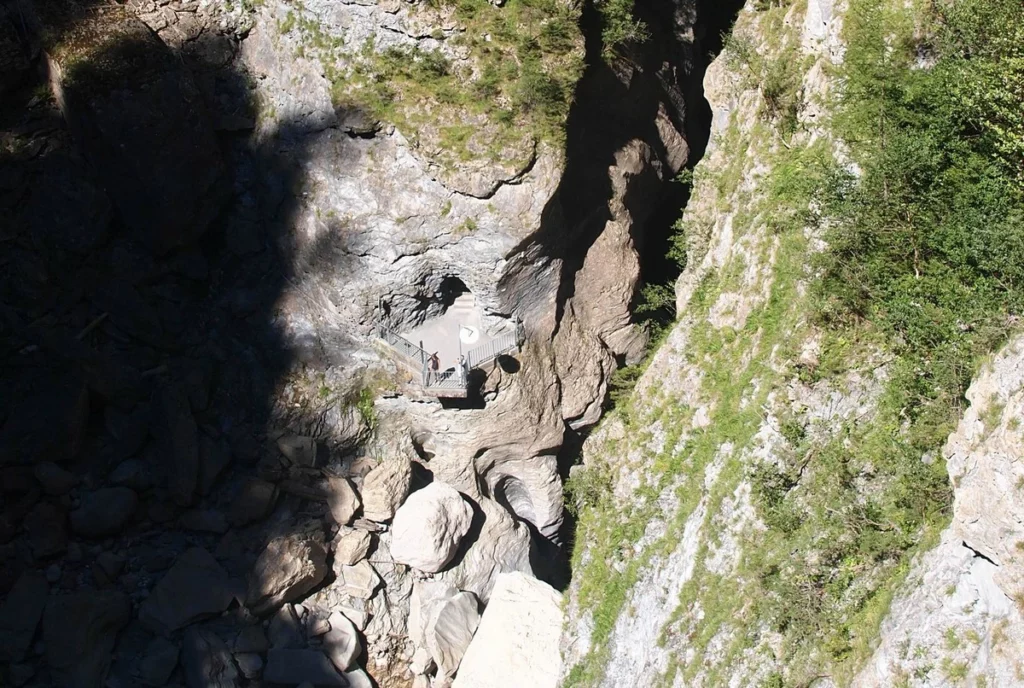
And we will begin to descend down to the main platform overlooking the Rhine cauldron. When planning a trip, think about the fact that the observation deck is oriented to the south with all the consequences (direct sun).

This is what I was able to get against the sun.
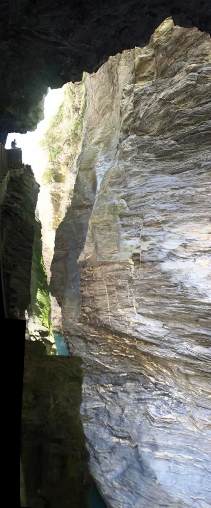
Now we rise back and pass into the second, northern gallery along a narrow gorge.
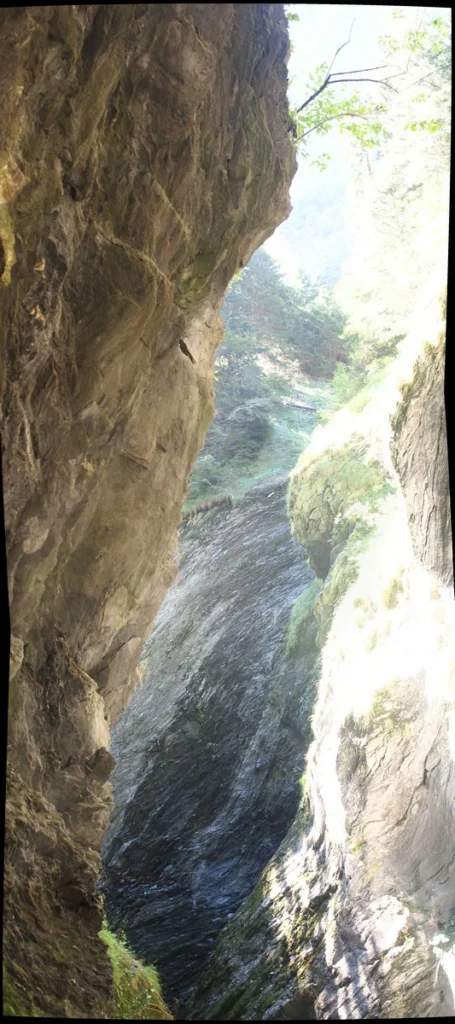
The man at the end of the gallery shows the dimensions of the gorge.
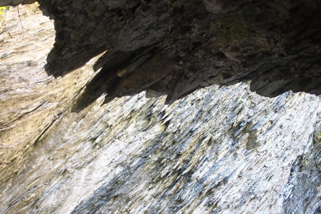
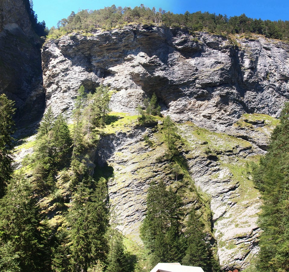
Let’s look around and up a bit. The walls are like caked sawdust, a layer cake cut through with a dull saw.
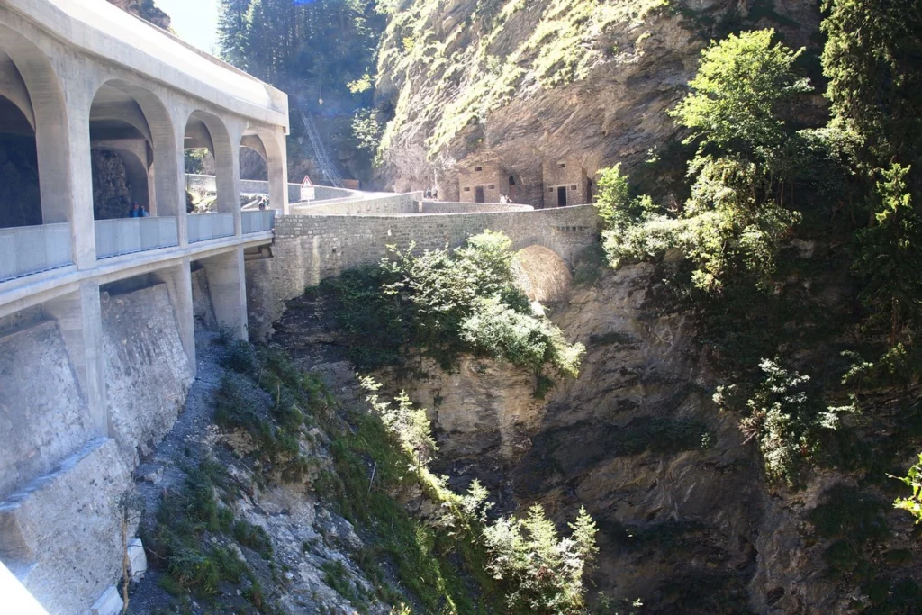
Let’s climb back to the visitor center and walk to the Wildener bridges. The architect Wildener built two bridges in the 18th century, of which one has survived (the one closer to us for pedestrians). This is how they look from the gorge. Almost Lord of the Rings.
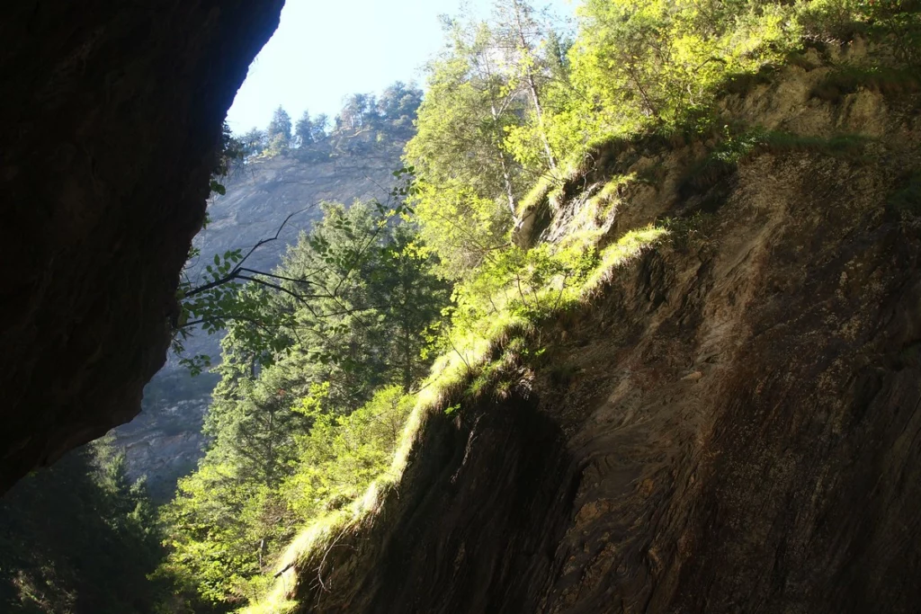
In the rooms inside the rock there are small rooms with a story about Viamala. The staircase in the background is a continuation of the hiking route. It is very shaky and tough. There are no views from there, since this is just a bypass of the roadway so that people do not fall under the wheels.
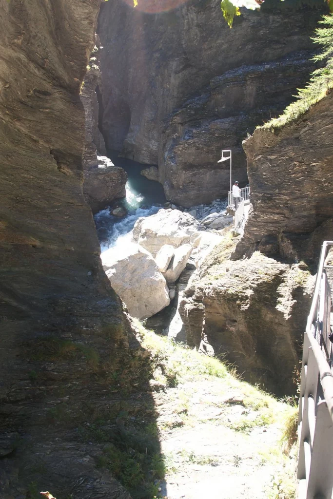
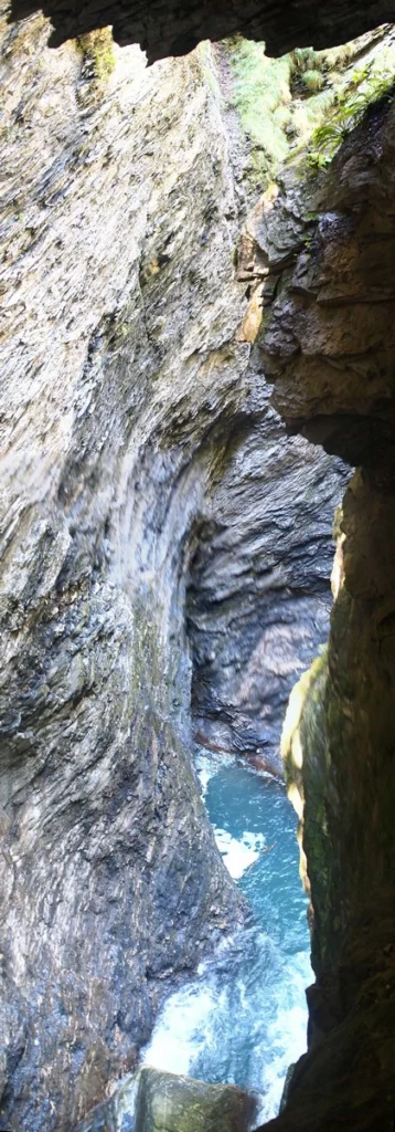
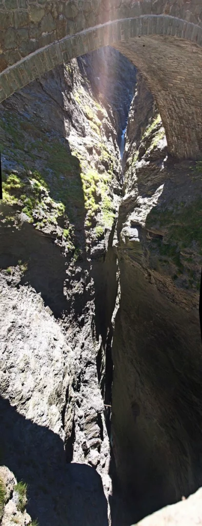
Let’s take a look from the bridge. To the south, the narrowest part. If you look closer, you can see water at the bottom.
To the north, a view of the visitor center where we’ve just been.
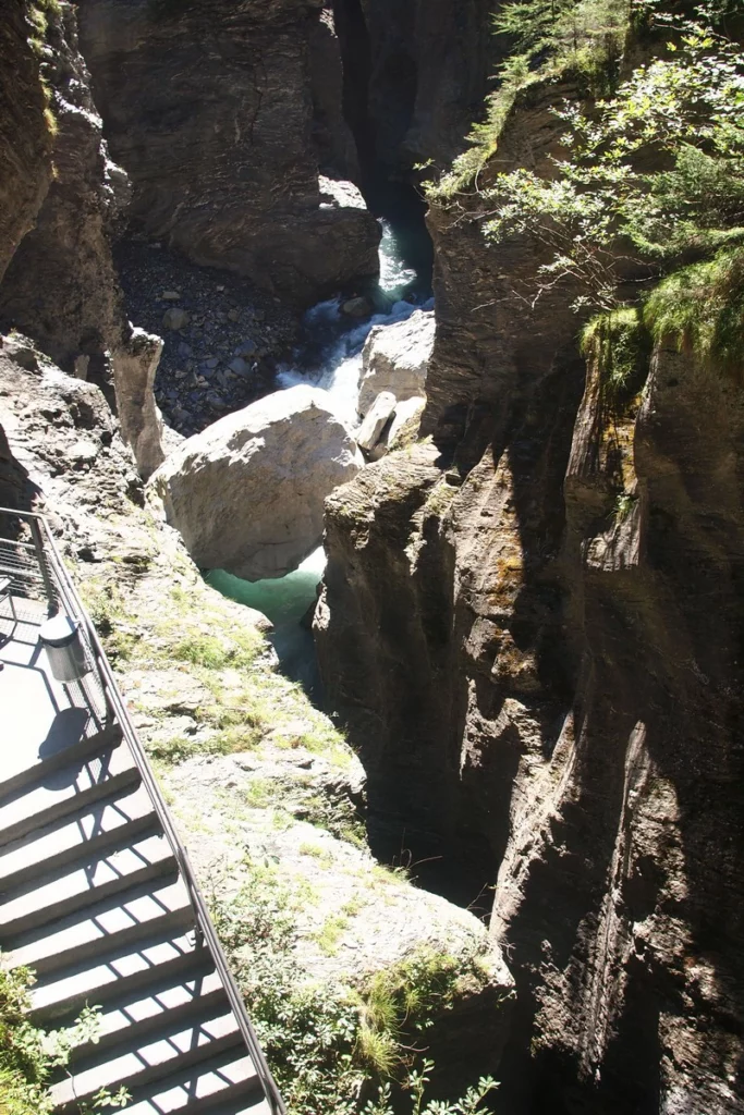
Let’s zoom in on the bottom. You can see stairs and a platform overlooking the Rhine cauldron.
The view to the top is equally breathtaking. The rest of the 300 meters of slopes hangs overhead.
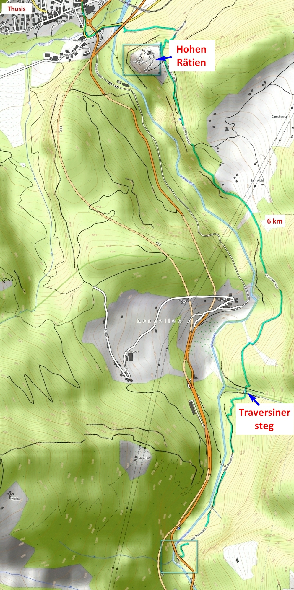
For those who will hike, there are several routes. The main and most known Veia Traversina runs along the gorge and is 11 km in total.
Public transport. You can come to Thusis by train, bus 541 stops in Zillis (sometimes it also stops at the visitor center).
What can be seen? Let’s start from Zillis, that is, from the south.
Zillis
Church of St. Martin, called the Sistine Chapel of the Alps. Ceiling paintings from the early 12th century. Museum dedicated to the church. Link
Burg Haselstein without visiting


Next is the Saransuns Suspension Bridge. Here the narrow gorge is just about to begin, the bridge is down by the river. Then you climb the slopes without seeing the gorge itself, since it is as narrow as possible in this place.
After visiting the visitor centre, the next interesting place is the Traversinersteg suspension bridge, and then at the end of the path, as a bonus, the Hohen Rätien fortification is very picturesquely located on a hill. After it, you can immediately go down to Thusis by a short path or go further down the slope to the next fortress and to the Sils station, which will lengthen the path by about a kilometer.
This is how your walk towards Thusis will look like.

(3)
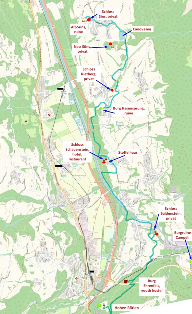
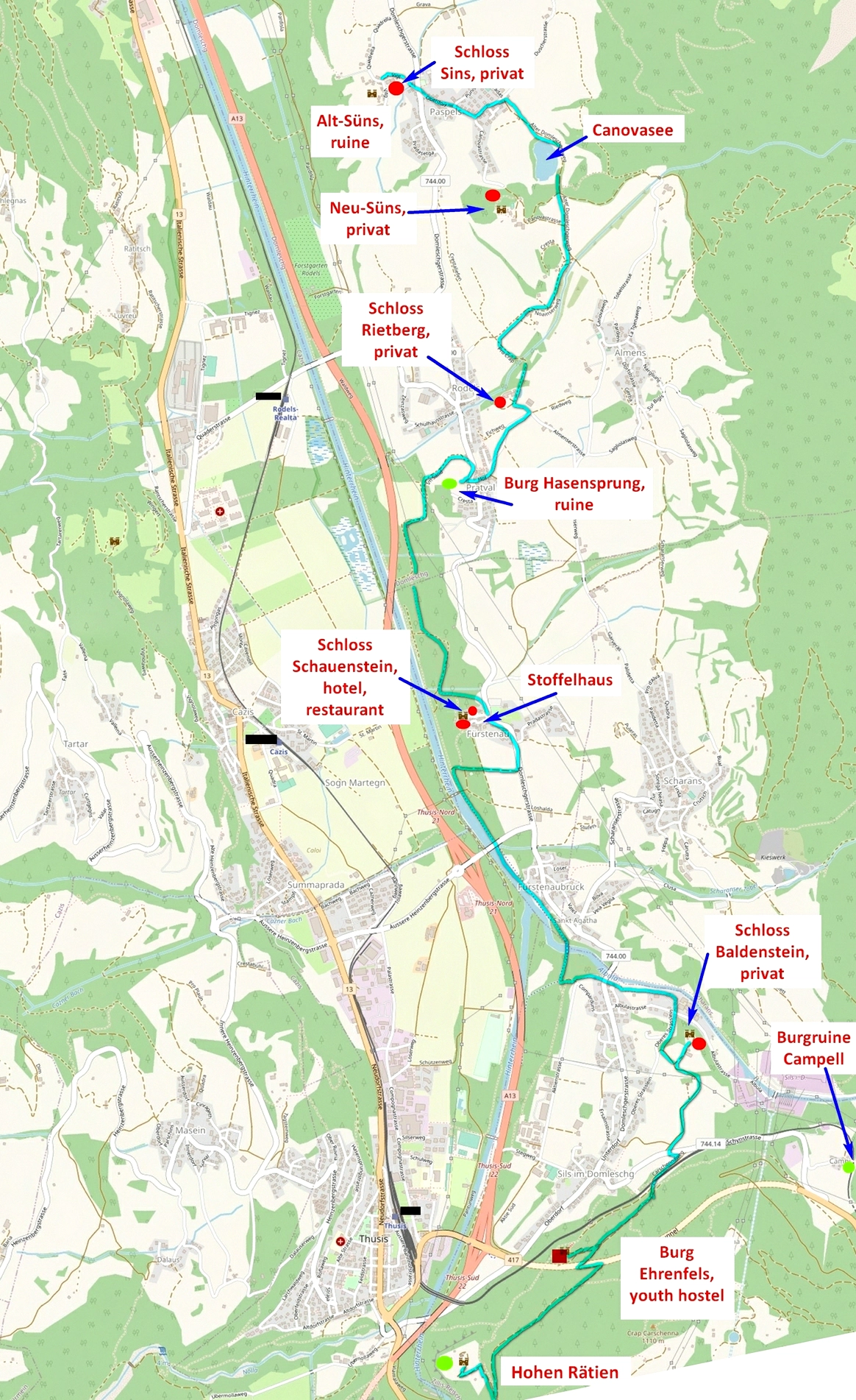
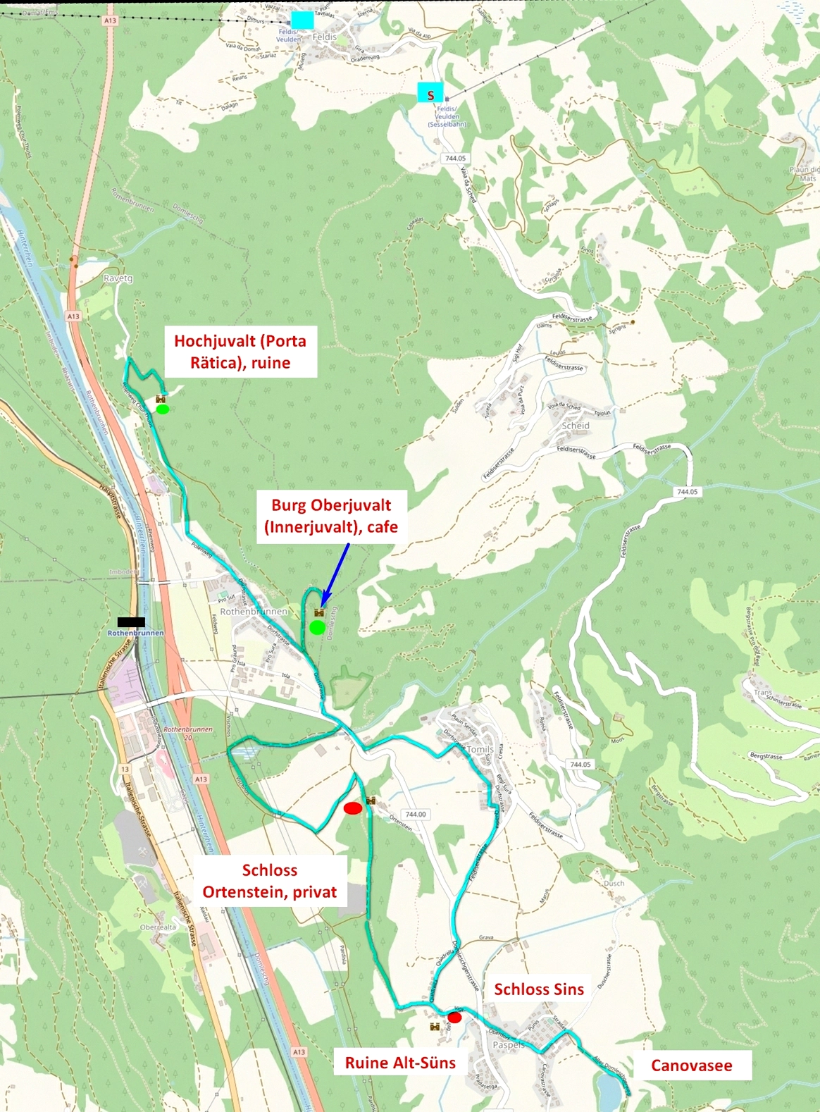
11. Thusis, Mutten
From Thusis begins a number of fortresses and castles, most of which are privately owned, that is, you can only see from the outside. The route is called Burgenweg Domleschg. Length 16 km.
Bus 512 runs along this side of the river.
I will only list the places you can visit. The rest of the castles, which can only be viewed from the outside, are indicated on the maps.
You can visit the already mentioned Hohen Rätien fortification. Link This fortification on an almost impregnable rock at the entrance to Viamala served as a stopover for travelers on their way south. There was a small number of fortifications, a tower, a church, a room for spending the night. The place has been inhabited since the Bronze Age. The fortifications were destroyed by an earthquake at the end of the 13th century and gradually fell into disrepair. Nowadays it has been restored.
The next point for visit is the ruins of Campell castle. These are typical ruins of a small castle (free of charge).
You can see murals from the early 15th century in the Stoffelhaus in Fürstenau, but by appointment only. Link
Lake Canova – a beautiful lake with swimming (for a fee).
Innerjuvalt – small castle with cafe.

All topics related to #graubünden
Do you enjoy the site without cookies? This means that I work for you at my own expense.
Perhaps you would like to support my work here.
Or change your cookie settings here. I don’t use personalized ads


